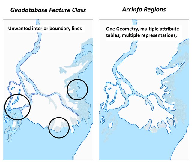
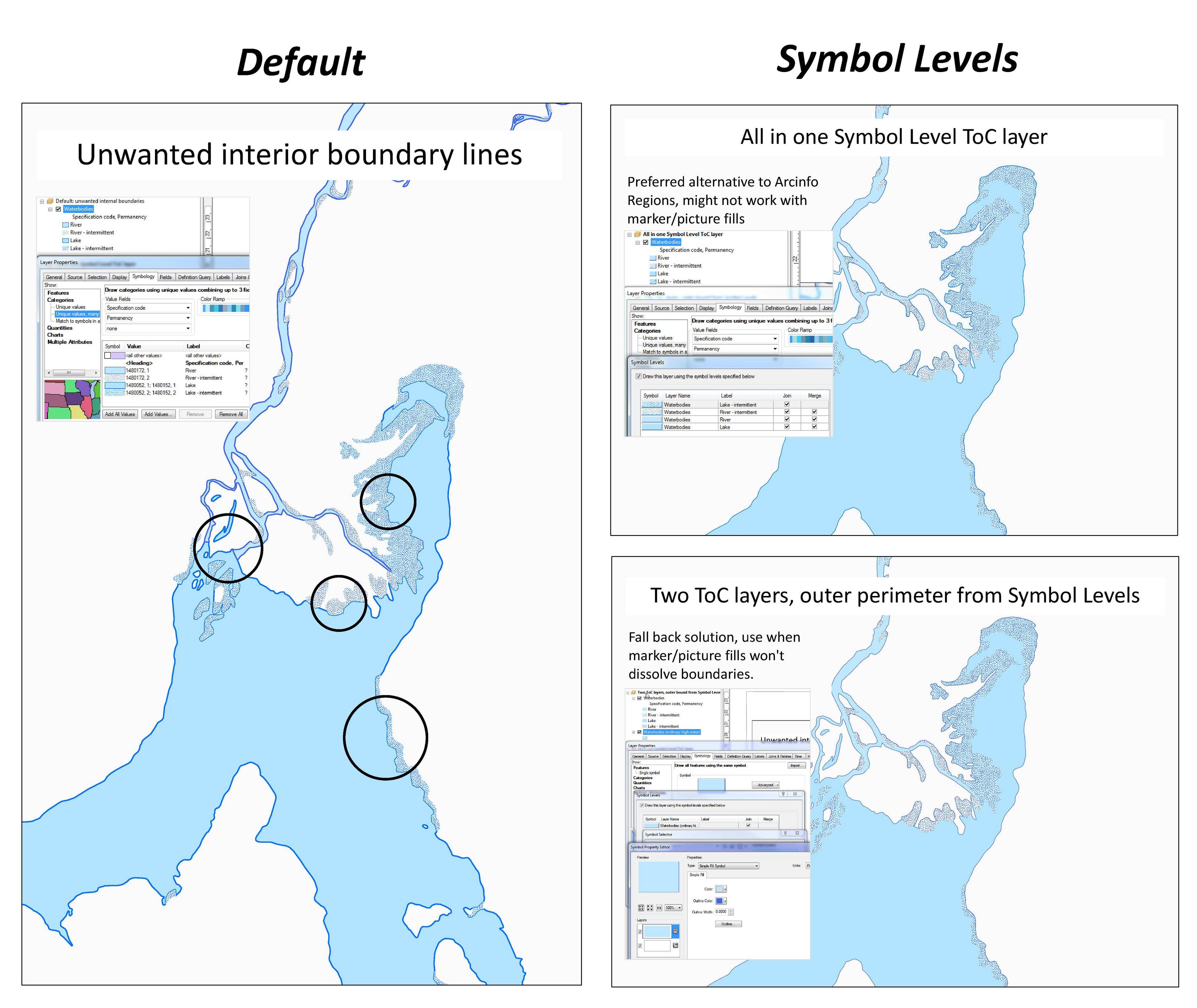
Our task is to draw a lake with a solid outer perimeter line and no lines between internal wetlands, shoals and shallows? 'Tis a relatively straightforward process with Arcinfo coverages and Regions, but alas, that is no longer a viable option for us, the datasets we use now are too large and the lack coverage editing ability in Arcmap crucial. Can cartographic representation solve our dilemma? Is it possible to create something like the below without resorting to creating (and managing) duplicating, or triplicating, geometries whose sole purpose is better looking maps?
 (click through for more detail)
With a feature class: Boundary between river and lake is visible. Keeping them as distinct polygons in one feature class allows a name attribute (the river and laker differ). Elsewhere the heavy line implies a sharp boundary between lake and shallows/intermittent lake, however the actual edge is indeterminate, fluctuating with seasons and high-low water cycles. The line should be implied rather than drawn.
With regions: One geometry, multiple attribute tables, multiple representations.
- Outer perimeter (ordinary high water mark) is cleanly delineated
- No apparent division between lake and river, but they still know which is which
- Shallow/intermittent waters are symbolized appropriately, with river shallows distinguished from lake shallows.
See here for a map package simulation of what we're trying to achieve and the source arcinfo region coverage from which it is built.


