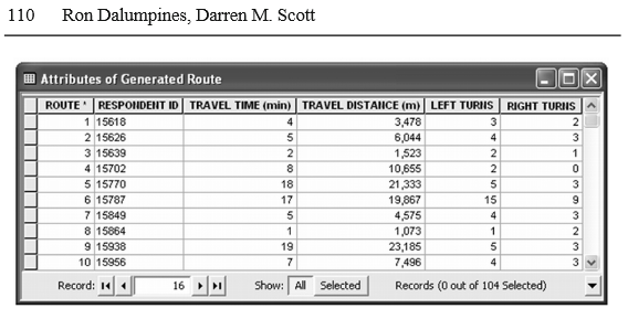
When considering turns as features in a network dataset, they must be modeled first. That means you have to create an actual turns feature class that has its own geometry to be traversed. When turns are not specifically modeled (ie, the Global Turns properties you mention) they aren't features that are traversed, just analysis variable properties, which is why your table is blank.
Usually turns are only modeled in special circumstances, for instance when they need to be restricted at a particular intersection. However it is possible to model every turn in the network. I've never attempted to do this on my own, and I'm not sure if there are any automated tools to generate the turn features for an entire network at once. Before committing to creating a full turns feature class, you might just create a few sample ones that would fall on your routes and then use that to test if it produces the desired attributes or something useful to work with.
I cannot say if those attributes in your example image were generated using this tool/method. Based on the Copy Traversed Source Features help files, and specifically the output documentation, it does not appear that this tool will generate the information you want. I also found this GeoNet forum post with the same goal as you, and my interpretation of the information there is the tool doesn't produce that information. (The suggested solution there is also to use Directions, and explains briefly how it comes up with left/right.)

