i am looking for ward Boundary of major city of India Like Jhansi, i have try some sites where ward boundary is available like urban master plan and sildeshere but not found
-
1Welcome to GIS SE, have you tried looking on the specific city GIS website for this data download?– artwork21Commented Aug 17, 2016 at 10:26
-
yes i have try Municipal corporations side but they don't have so i request if any one have ward boundary– harshCommented Aug 17, 2016 at 11:19
-
In South Africa, ward boundaries fall under the Demarcation Board, so the shapefiles are available on their website. Does India not have a similar body in charge of the ward boundaries?– Cindy JayakumarCommented Aug 17, 2016 at 12:23
-
If this is likely to be open data then asking at the Open Data Stack Exchange is recommended.– PolyGeo ♦Commented Jul 14, 2017 at 5:33
1 Answer
You could try DIVA-GIS where you can select India as Country and Administrative areas as Subject. You should receive three polygon shapefiles.
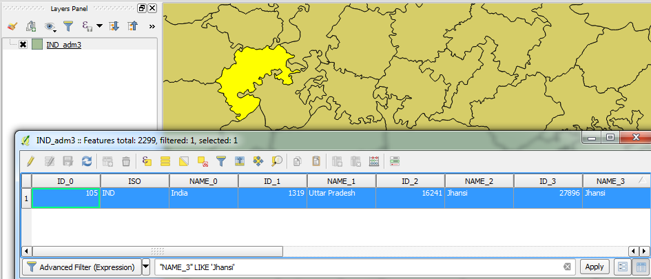
Load the "IND_adm3.shp" shapefile into your GIS software, open the Attribute Table and in the NAME_3 field, search for 'Jhansi'.
In QGIS, you can write an expression like:
"NAME_3" LIKE 'Jhansi'
There should only be one feature:
Jhansi also exists in the NAME_2 field where four features exist but I believe those show the Jhansi district and not the city.

