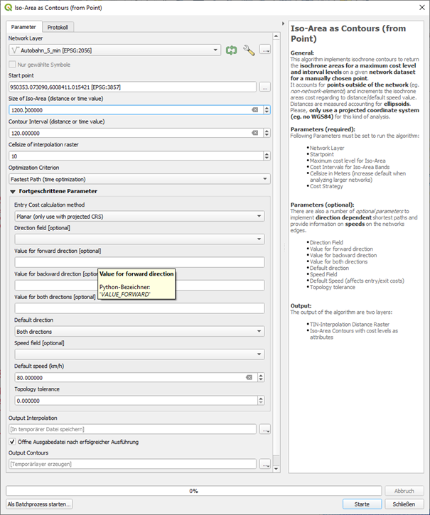
You can use the QNEAT plugin for that. You can select the Iso-Areas entry (accessible in the processing toolbox) and than select iso-area as contours (from Point). It creates both a raster containing isochrone information as well as vector lines, representing isochrones. See the settings I made - on the bottom, you can define a speed. There are optional settings for varying speed, then you can take the value from an attribute of the road network.
Size of iso-area is the max. distance (in time) that is calculated. It's in seconds, so my 1200 [s] represents 20 min - if you need a larger area, adjust the settings. I created contours for every 2 minutes (120 sec.). Be sure to select fastest path:
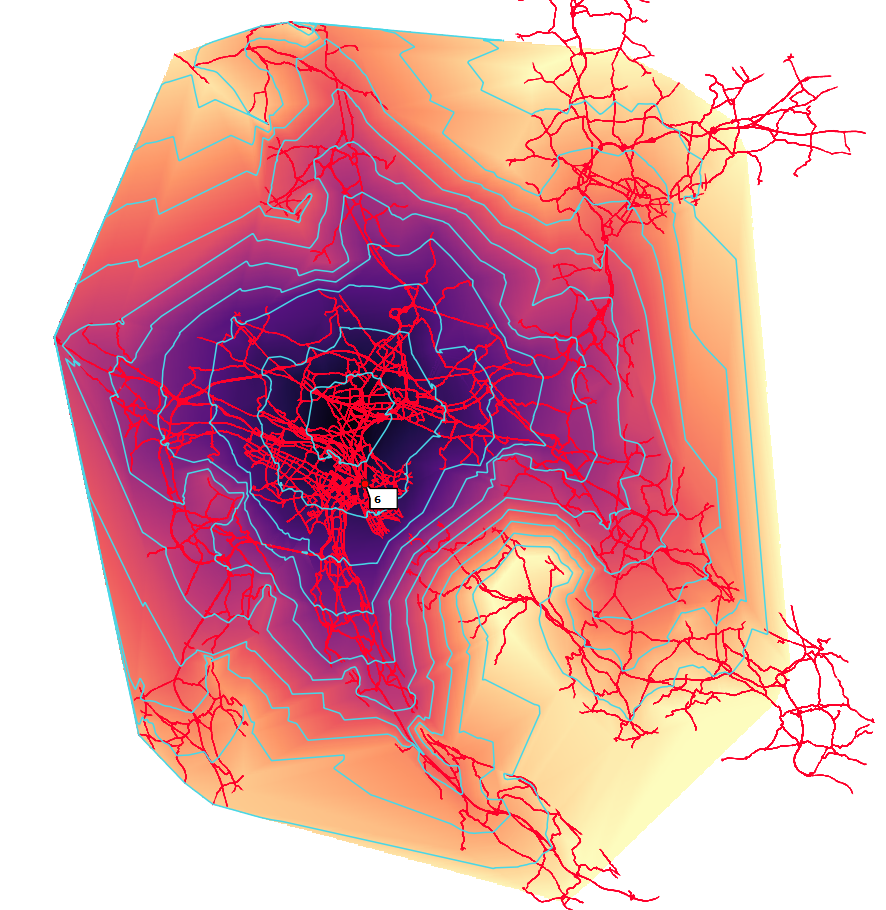
 And this is how the output looks like:
Red lines: original roads network (input) - the input point is not shown here - in the above dialogue window, you can select it by pointing to the map (use snapping to snap to a road segment).
blue lines: output of the algorithm (isochrone lines)
colored raster: output of the algorithm (isochrone raster)


