added 4 characters in body
Source Link
traggatmot
  • 2.1k
  • 1
  • 24
  • 45

Edit:Edit: More information. It seems that the WL algorithm leads to wider less distinct channels, causing high topographic index values (my final derivative data set). The image on the left below is the PD algorithm, the image on the right is the WL algorithm.
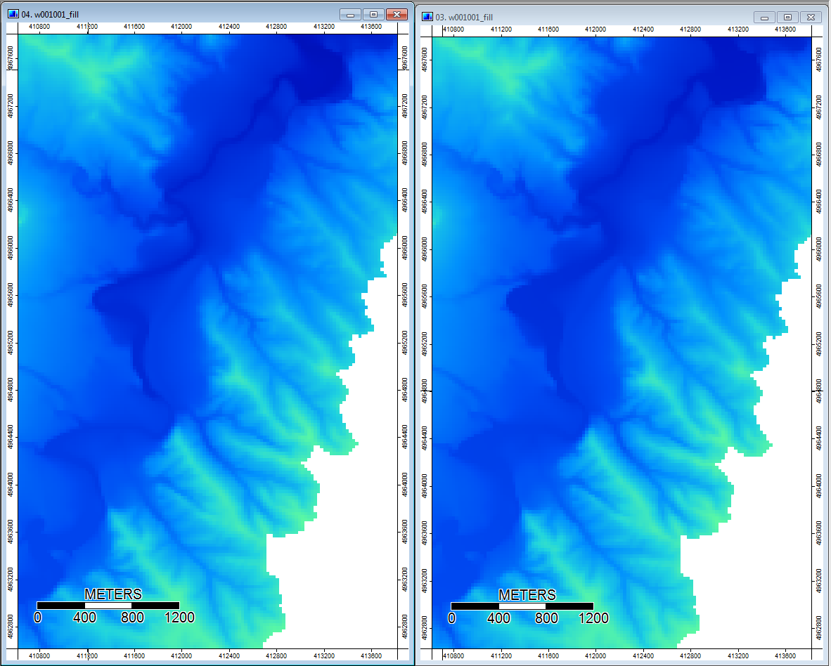
Edit: More information. It seems that the WL algorithm leads to wider less distinct channels, causing high topographic index values (my final derivative data set). The image on the left below is the PD algorithm, the image on the right is the WL algorithm.

Edit: More information. It seems that the WL algorithm leads to wider less distinct channels, causing high topographic index values (my final derivative data set). The image on the left below is the PD algorithm, the image on the right is the WL algorithm.

added 368 characters in body
Source Link
traggatmot
  • 2.1k
  • 1
  • 24
  • 45

These images show the difference in topographic index at the same locations - wider wetter areas (more channel - redder, higher TI) in the WL pic on the right; narrower channels (less wet area - less red, narrower red area, lower TI in area) in the PD pic on the left.

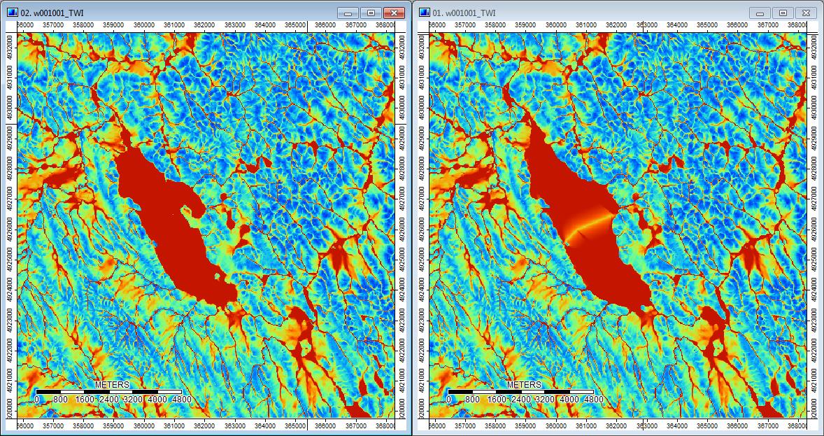
Additionally, here is how PD handled (left) a depression and how WL handled it (right) - notice the raised orange (lower Topographic index) segment/line crossing through the depression in the WL filled output?

enter image description here

These images show the difference in topographic index at the same locations - wider wetter areas (more channel) in the WL pic on the right; narrower channels (less wet area) in the PD pic on the left.
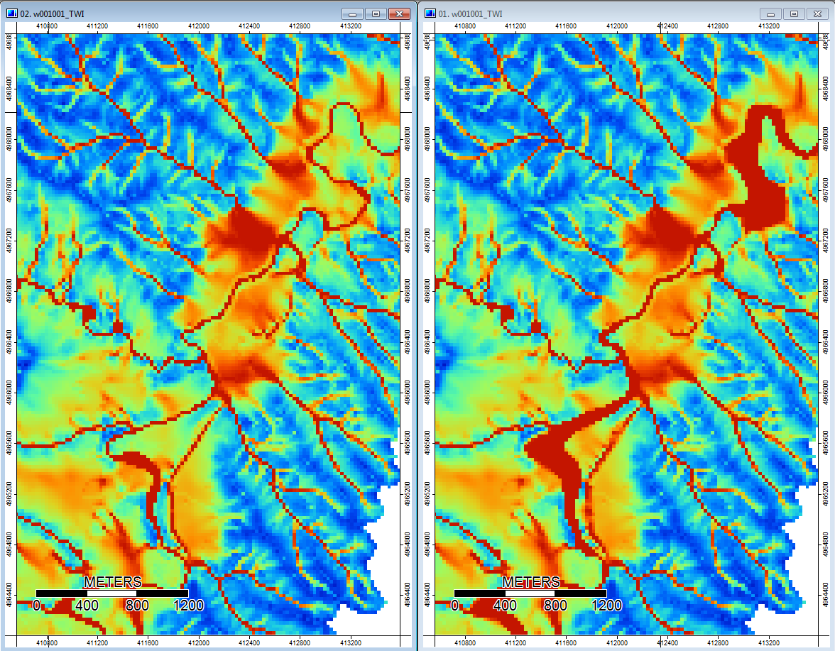
These images show the difference in topographic index at the same locations - wider wetter areas (more channel - redder, higher TI) in the WL pic on the right; narrower channels (less wet area - less red, narrower red area, lower TI in area) in the PD pic on the left.

Additionally, here is how PD handled (left) a depression and how WL handled it (right) - notice the raised orange (lower Topographic index) segment/line crossing through the depression in the WL filled output?

enter image description here

added 719 characters in body
Source Link
traggatmot
  • 2.1k
  • 1
  • 24
  • 45

Edit: More information. It seems that the WL algorithm leads to wider less distinct channels, causing high topographic index values (my final derivative data set). The image on the left below is the PD algorithm, the image on the right is the WL algorithm.

enter image description here

These images show the difference in topographic index at the same locations - wider wetter areas (more channel) in the WL pic on the right; narrower channels (less wet area) in the PD pic on the left.

enter image description here

So the differences, however small, do seem to trickle through the additional analyses.
Source Link
traggatmot
  • 2.1k
  • 1
  • 24
  • 45
Loading