deleted 11 characters in body
Source Link
WhiteboxDev
  • 11.1k
  • 1
  • 36
  • 65

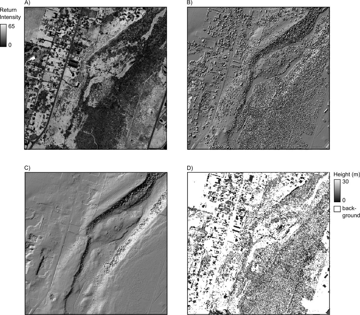
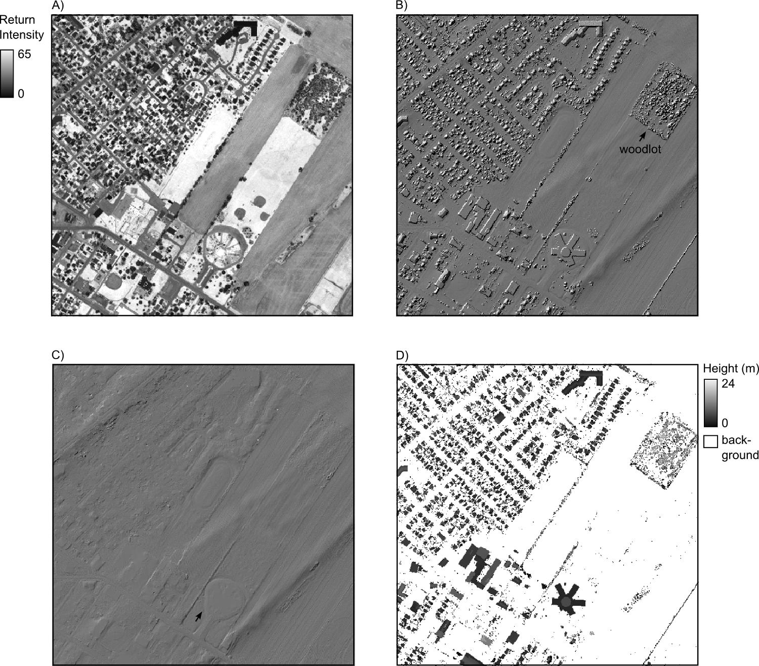
If you have a raster DEM already, then there is a tool that I developed in Whitebox Geospatial Analysis Tools called Remove Off-Terrain Objects, contained within the LiDAR toolbox, that works well for creating bare-earth DEMs, particularly in urban and agricultural settings. It works less well where either the terrain is steeply sloped or the forest cover is dense but it can still be useful under these settings. Compare part B (hillshade of original DEM) and part C (bare earth after processing with tool) in the figures below. Ultimately however @recurvata and @vklopt are rightis correct in saying that the classification will be best if you can get the original source LiDAR data from which the grid was derived.
enter image description here

enter image description here

If you have a raster DEM already, then there is a tool that I developed in Whitebox Geospatial Analysis Tools called Remove Off-Terrain Objects, contained within the LiDAR toolbox, that works well for creating bare-earth DEMs, particularly in urban and agricultural settings. It works less well where either the terrain is steeply sloped or the forest cover is dense but it can still be useful under these settings. Compare part B (hillshade of original DEM) and part C (bare earth after processing with tool) in the figures below. Ultimately however @recurvata and @vklopt are right in saying that the classification will be best if you can get the original source LiDAR data from which the grid was derived.

enter image description here

enter image description here

If you have a raster DEM already, then there is a tool that I developed in Whitebox Geospatial Analysis Tools called Remove Off-Terrain Objects, contained within the LiDAR toolbox, that works well for creating bare-earth DEMs, particularly in urban and agricultural settings. It works less well where either the terrain is steeply sloped or the forest cover is dense but it can still be useful under these settings. Compare part B (hillshade of original DEM) and part C (bare earth after processing with tool) in the figures below. Ultimately however @recurvata is correct in saying that the classification will be best if you can get the original source LiDAR data from which the grid was derived.

enter image description here

enter image description here

Source Link
WhiteboxDev
  • 11.1k
  • 1
  • 36
  • 65

If you have a raster DEM already, then there is a tool that I developed in Whitebox Geospatial Analysis Tools called Remove Off-Terrain Objects, contained within the LiDAR toolbox, that works well for creating bare-earth DEMs, particularly in urban and agricultural settings. It works less well where either the terrain is steeply sloped or the forest cover is dense but it can still be useful under these settings. Compare part B (hillshade of original DEM) and part C (bare earth after processing with tool) in the figures below. Ultimately however @recurvata and @vklopt are right in saying that the classification will be best if you can get the original source LiDAR data from which the grid was derived.

enter image description here

enter image description here