To add more information
Source Link
xunilk
  • 30.2k
  • 4
  • 43
  • 82

The problem is that your individual rasters are not aligned. So, when they are added the result is a weighted average for the values in the overlaping area. To solve this you have to use a merged vector layer whose extension must be used for producing individual raster. I used this procedure for testing it:

  1. I created two vector layers (both with the same value field = 10) where they are overlaped in some area:
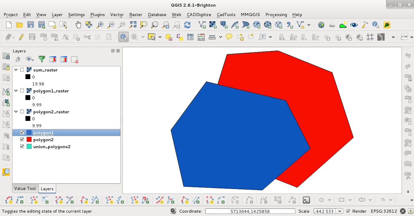
enter image description here

  1. I merged them and I wrote down its extension:
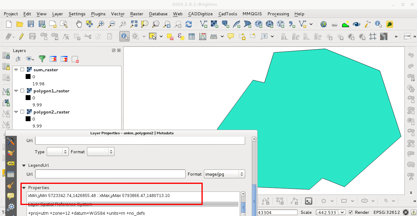
enter image description here

  1. Using the extension to rasterize (by value field = 10) the first vector layer:
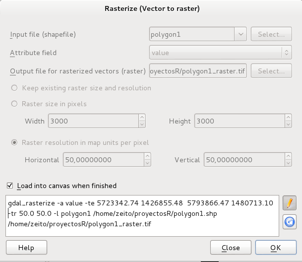
enter image description here

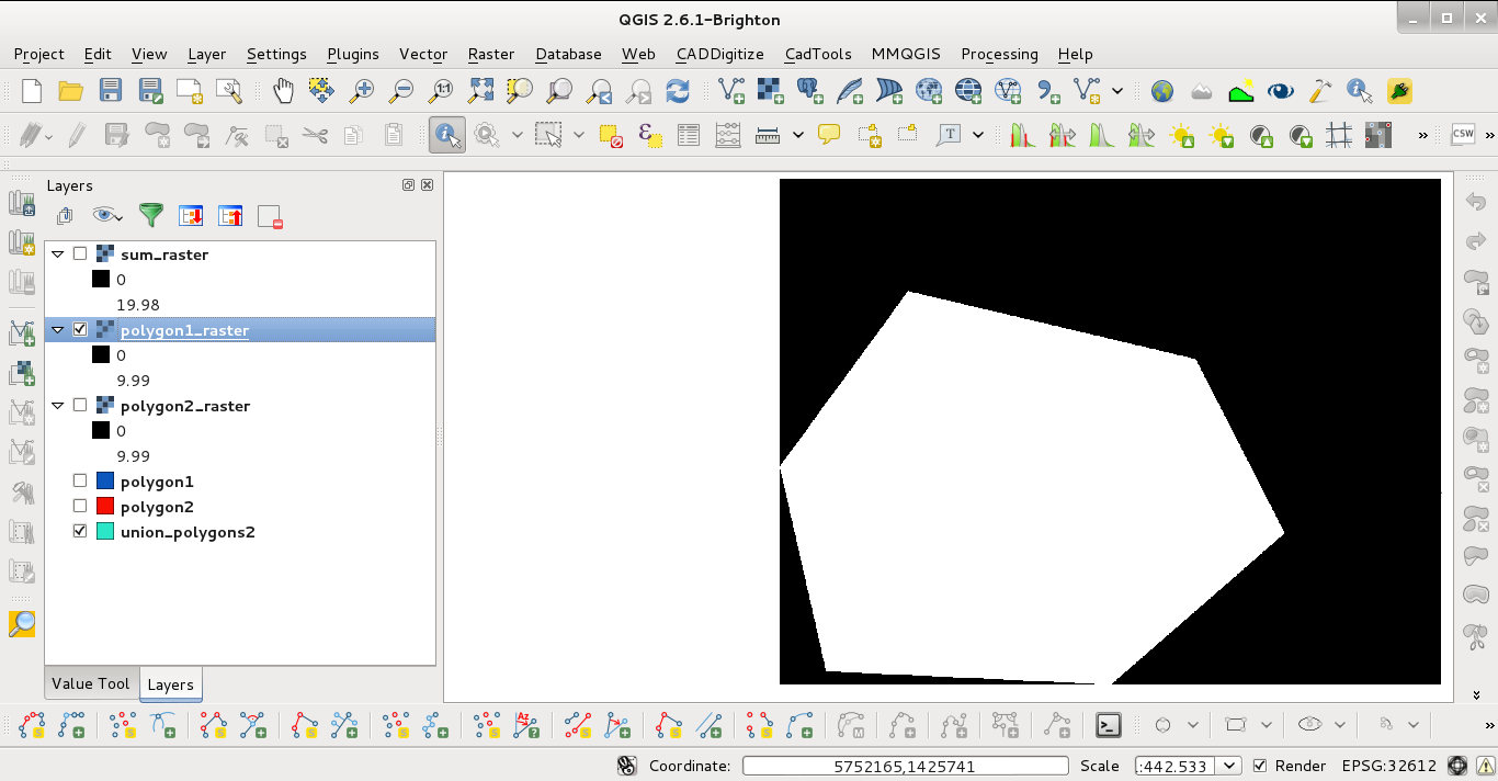
  1. First vector layer rasterized:

enter image description here

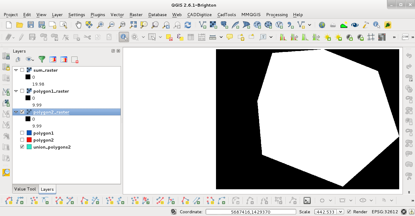
  1. Second vector layer rasterized:

enter image description here

  1. sum_raster obtained by using raster calculator. You can observe that the sum is 20 in overlaped areas (Value Tool plugin). The values: 0 (black area), 10 (gray area), 20 (white area).
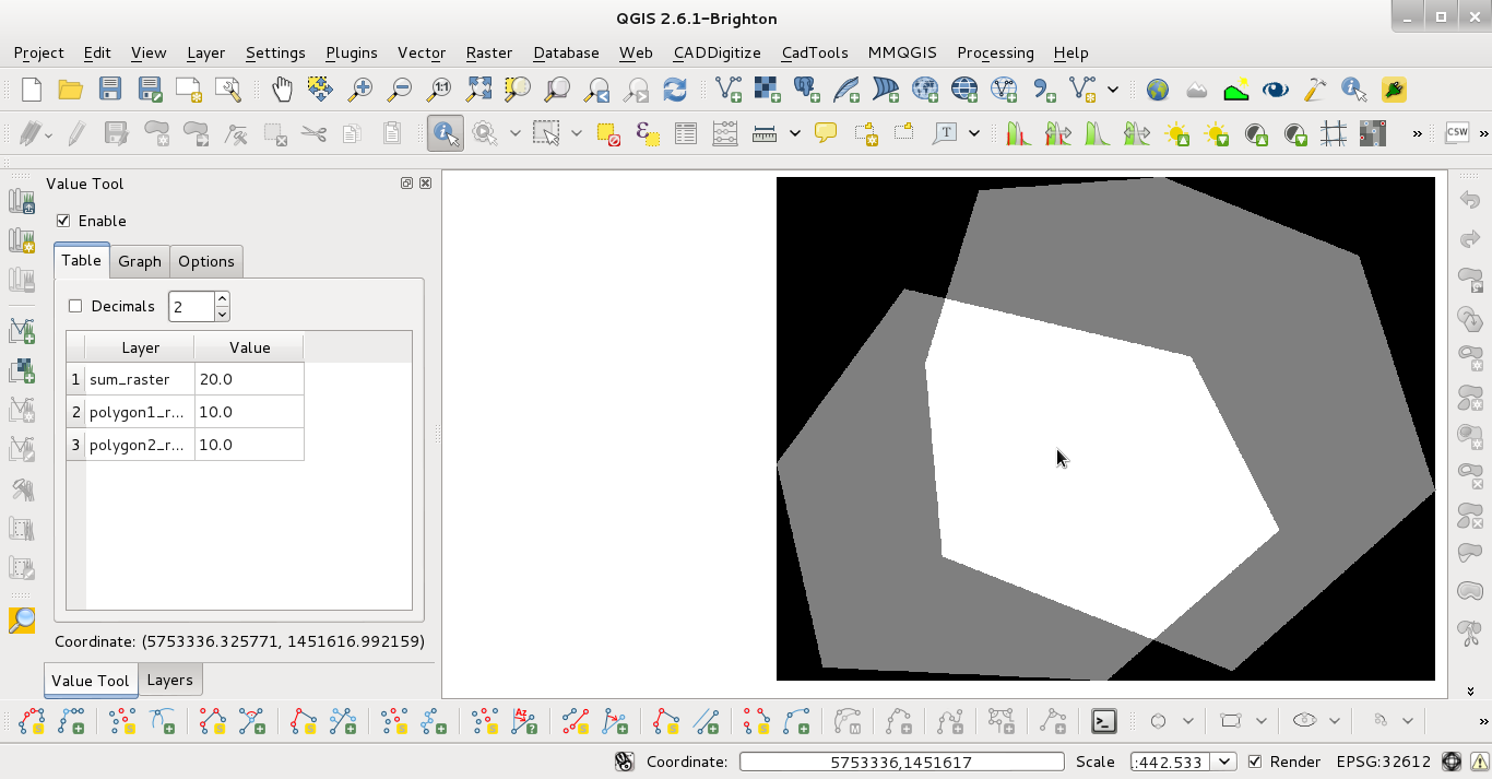
enter image description here

The problem is that your individual rasters are not aligned. So, when they are added the result is a weighted average for the values in the overlaping area. To solve this you have to use a merged vector layer whose extension must be used for producing individual raster. I used this procedure for testing it:

  1. I created two vector layers where they are overlaped in some area:

enter image description here

  1. I merged them and I wrote down its extension:

enter image description here

  1. Using the extension to rasterize the first vector layer:

enter image description here

  1. First vector layer rasterized:

enter image description here

  1. Second vector layer rasterized:

enter image description here

  1. sum_raster obtained by using raster calculator. You can observe that the sum is 20 in overlaped areas (Value Tool plugin).

enter image description here

The problem is that your individual rasters are not aligned. So, when they are added the result is a weighted average for the values in the overlaping area. To solve this you have to use a merged vector layer whose extension must be used for producing individual raster. I used this procedure for testing it:

  1. I created two vector layers (both with the same value field = 10) where they are overlaped in some area:

enter image description here

  1. I merged them and I wrote down its extension:

enter image description here

  1. Using the extension to rasterize (by value field = 10) the first vector layer:

enter image description here

  1. First vector layer rasterized:

enter image description here

  1. Second vector layer rasterized:

enter image description here

  1. sum_raster obtained by using raster calculator. You can observe that the sum is 20 in overlaped areas (Value Tool plugin). The values: 0 (black area), 10 (gray area), 20 (white area).

enter image description here

Source Link
xunilk
  • 30.2k
  • 4
  • 43
  • 82

The problem is that your individual rasters are not aligned. So, when they are added the result is a weighted average for the values in the overlaping area. To solve this you have to use a merged vector layer whose extension must be used for producing individual raster. I used this procedure for testing it:

  1. I created two vector layers where they are overlaped in some area:

enter image description here

  1. I merged them and I wrote down its extension:

enter image description here

  1. Using the extension to rasterize the first vector layer:

enter image description here

  1. First vector layer rasterized:

enter image description here

  1. Second vector layer rasterized:

enter image description here

  1. sum_raster obtained by using raster calculator. You can observe that the sum is 20 in overlaped areas (Value Tool plugin).

enter image description here