deleted 39 characters in body; edited tags
Source Link
PolyGeo
  • 65.4k
  • 29
  • 114
  • 345

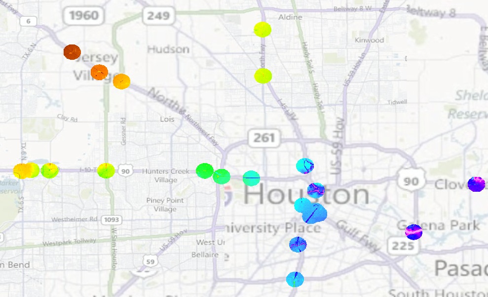
Please refer to the attached image. The overlay on the map shows a raster file with disconnected circles. I want to split each of those circles into independent rasters in one shot. 

Is that even possible? If yes how? If not whats the fastest way to do it (avoiding as much donkey work as possible)?
enter image description here

Please refer to the attached image. The overlay on the map shows a raster file with disconnected circles. I want to split each of those circles into independent rasters in one shot. Is that even possible? If yes how? If not whats the fastest way to do it (avoiding as much donkey work as possible)?

enter image description here

Please refer to the attached image. The overlay on the map shows a raster file with disconnected circles. I want to split each of those circles into independent rasters in one shot. 

Is that even possible? If yes how? If not whats the fastest way to do it?

enter image description here

Source Link
Shaunak
  • 999
  • 1
  • 10
  • 26

How to Separate out the disconnected regions of a raster into independent rasters using ArcGIS?

Please refer to the attached image. The overlay on the map shows a raster file with disconnected circles. I want to split each of those circles into independent rasters in one shot. Is that even possible? If yes how? If not whats the fastest way to do it (avoiding as much donkey work as possible)?

enter image description here