added 363 characters in body
Source Link
Brad Nesom
  • 17.4k
  • 2
  • 44
  • 68

Using esri streetmap data you can get an idea of how to accomplish multiple zoom levels on 1 layer. You should either have a dvd that came with your product or can download it with your global login at my.esri.com. For example in the transportation layer group they have road with multiple zoom levels. No matter what scale you zoom to one of them turns on. You don't describe what data you are wanting to zoom to (and view).
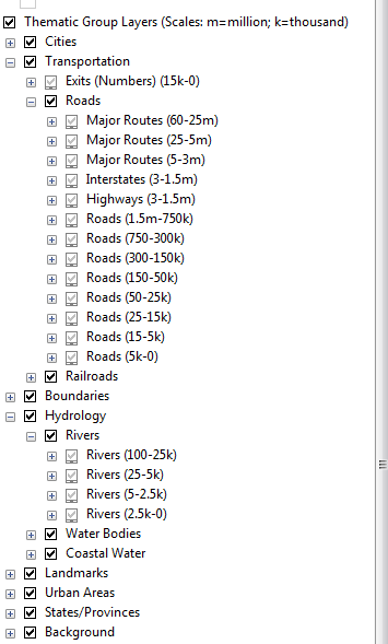
zoom dependency

As you described in your question these are a copy of the same layer grouped
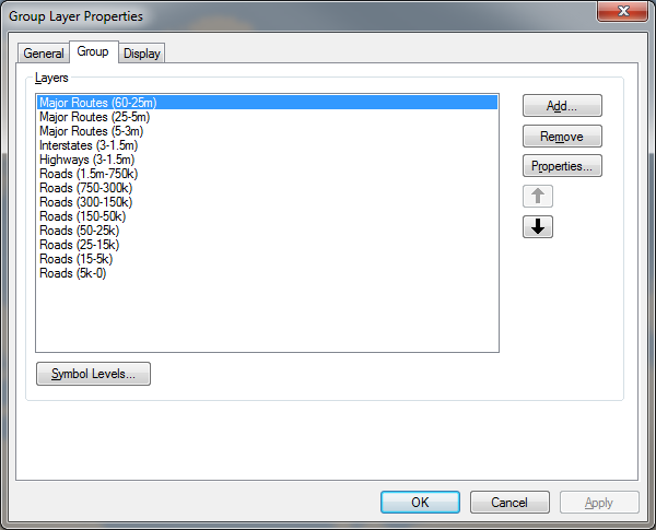
Layer group
with only "some" of the data shown while zoomed out.
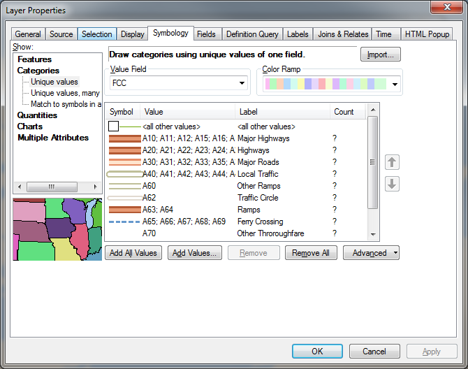
Zoom symbology
Here esri uses FCC code to only show some codes at differing levels.
You might have to build some data to use at scale levels in your data and make your own dependency on.
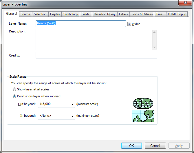
Scale dependency
If this standard solution doesn' twork it sounds more like you are trying to build an app that will automate the process (not a cartographic solution).

If you are a programmer then you can utilize the create layer from selected.
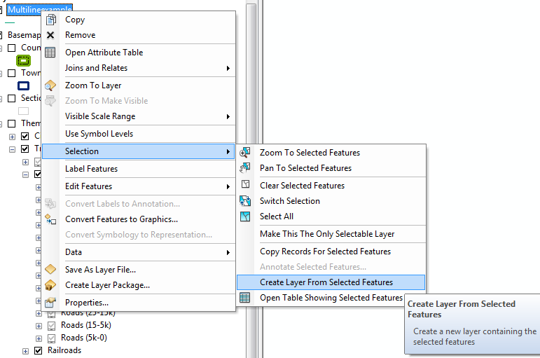
Selected
But that doesn't really answer the question as stated.

Using esri streetmap data you can get an idea of how to accomplish multiple zoom levels on 1 layer. You should either have a dvd that came with your product or can download it with your global login at my.esri.com. For example in the transportation layer group they have road with multiple zoom levels. No matter what scale you zoom to one of them turns on. You don't describe what data you are wanting to zoom to (and view).
zoom dependency

As you described in your question these are a copy of the same layer grouped
Layer group
with only "some" of the data shown while zoomed out.
Zoom symbology
Here esri uses FCC code to only show some codes at differing levels.
You might have to build some data to use at scale levels in your data and make your own dependency on.
Scale dependency
If this standard solution doesn' twork it sounds more like you are trying to build an app that will automate the process (not a cartographic solution).

If you are a programmer then you can utilize the create layer from selected.
Selected
But that doesn't really answer the question as stated.

Source Link
Brad Nesom
  • 17.4k
  • 2
  • 44
  • 68

Using esri streetmap data you can get an idea of how to accomplish multiple zoom levels on 1 layer. You should either have a dvd that came with your product or can download it with your global login at my.esri.com. For example in the transportation layer group they have road with multiple zoom levels. No matter what scale you zoom to one of them turns on. You don't describe what data you are wanting to zoom to (and view).
zoom dependency

As you described in your question these are a copy of the same layer grouped
Layer group
with only "some" of the data shown while zoomed out.
Zoom symbology
Here esri uses FCC code to only show some codes at differing levels.
You might have to build some data to use at scale levels in your data and make your own dependency on.
Scale dependency