added 425 characters in body
Source Link
AndreJ
  • 77.1k
  • 5
  • 88
  • 163

For a large-scale map, it does not really matter if the latlong coordinates are based on Pulkovo datum or WGS84. The longitudes seem to be based on Greenwich (not Ferro that was used before).

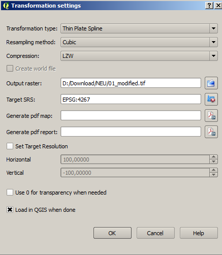
So you can grab as much graticule intersections you find ( I used 49), and use the following parameters:

enter image description here

To work with the image in QGIS, try a custom lcc CRS based on the 100° meridian (that seems to be the vertical one):

+proj=lcc +lat_1=30 +lat_2=62 +lat_0=0 +lon_0=100 +x_0=0 +y_0=0 +datum=WGS84 +units=m +no_defs

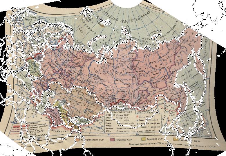
Compared with todays Natural Earth borders, it fits good:

enter image description here

The corners are distorted, but you have to live with that. Maybe other transformation types work a bit better. The far eastern part of siberiaSiberia gets lost, because the degree CRS cuts at 180° E.


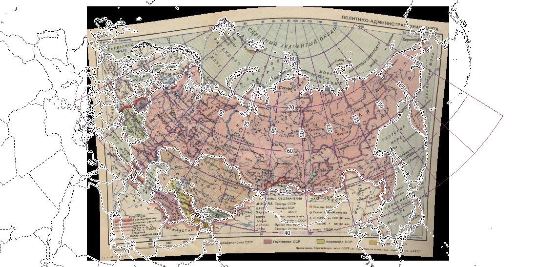
A different approach is to set the Pulkovo 1942 CRS as project CRS, create the same 15 x 10 degree vector grid as imprinted, and densify the geometry. Then change the project CRS to the custom lcc mentioned above, and georeference the grid intersections from the map canvas. Target CRS also has to be the lcc CRS. The result looks better now:

enter image description here

You can play with the parallels of the projection to improve the result further.

For a large-scale map, it does not really matter if the latlong coordinates are based on Pulkovo datum or WGS84. The longitudes seem to be based on Greenwich (not Ferro that was used before).

So you can grab as much graticule intersections you find ( I used 49), and use the following parameters:

enter image description here

To work with the image in QGIS, try a custom lcc CRS based on the 100° meridian (that seems to be the vertical one):

+proj=lcc +lat_1=30 +lat_2=62 +lat_0=0 +lon_0=100 +x_0=0 +y_0=0 +datum=WGS84 +units=m +no_defs

Compared with todays Natural Earth borders, it fits good:

enter image description here

The corners are distorted, but you have to live with that. Maybe other transformation types work a bit better. The far eastern part of siberia gets lost, because the degree CRS cuts at 180° E.

For a large-scale map, it does not really matter if the latlong coordinates are based on Pulkovo datum or WGS84. The longitudes seem to be based on Greenwich (not Ferro that was used before).

So you can grab as much graticule intersections you find ( I used 49), and use the following parameters:

enter image description here

To work with the image in QGIS, try a custom lcc CRS based on the 100° meridian (that seems to be the vertical one):

+proj=lcc +lat_1=30 +lat_2=62 +lat_0=0 +lon_0=100 +x_0=0 +y_0=0 +datum=WGS84 +units=m +no_defs

Compared with todays Natural Earth borders, it fits good:

enter image description here

The far eastern part of Siberia gets lost, because the degree CRS cuts at 180° E.


A different approach is to set the Pulkovo 1942 CRS as project CRS, create the same 15 x 10 degree vector grid as imprinted, and densify the geometry. Then change the project CRS to the custom lcc mentioned above, and georeference the grid intersections from the map canvas. Target CRS also has to be the lcc CRS. The result looks better now:

enter image description here

You can play with the parallels of the projection to improve the result further.
Source Link
AndreJ
  • 77.1k
  • 5
  • 88
  • 163

For a large-scale map, it does not really matter if the latlong coordinates are based on Pulkovo datum or WGS84. The longitudes seem to be based on Greenwich (not Ferro that was used before).

So you can grab as much graticule intersections you find ( I used 49), and use the following parameters:

enter image description here

To work with the image in QGIS, try a custom lcc CRS based on the 100° meridian (that seems to be the vertical one):

+proj=lcc +lat_1=30 +lat_2=62 +lat_0=0 +lon_0=100 +x_0=0 +y_0=0 +datum=WGS84 +units=m +no_defs

Compared with todays Natural Earth borders, it fits good:

enter image description here

The corners are distorted, but you have to live with that. Maybe other transformation types work a bit better. The far eastern part of siberia gets lost, because the degree CRS cuts at 180° E.