added 179 characters in body
Source Link
Inactivated Account
  • 18.9k
  • 5
  • 70
  • 114

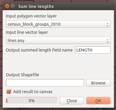
Give the Sum Line Lengths tool a try, from the Vector > Analysis Tools menu:

enter image description here

This will create a new shapefile that summarizes each input polygon vector layer feature by the length of input line vector layer.

The output shapefile should have an attribute field called LENGTH as you can see in the above screenshot, but you can change that to SUM_LENGTH or something similar.

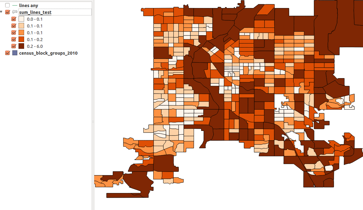
Then you can visualize your map on that field, if that is your purpose:

enter image description here

NOTE the units are important to your inputs, so in my example decimal degrees are not too meaningful...but if your input coordinate system is in metres you should be good.

Give the Sum Line Lengths tool a try, from the Vector > Analysis Tools menu:

enter image description here

This will create a new shapefile that summarizes each input polygon vector layer feature by the length of input line vector layer.

The output shapefile should have an attribute field called LENGTH as you can see in the above screenshot, but you can change that to SUM_LENGTH or something similar.

Then you can visualize your map on that field, if that is your purpose:

enter image description here

NOTE the units are important to your inputs, so in my example decimal degrees are not too meaningful...but if your input coordinate system is in metres you should be good.
Source Link
Inactivated Account
  • 18.9k
  • 5
  • 70
  • 114

Give the Sum Line Lengths tool a try, from the Vector > Analysis Tools menu:

enter image description here

This will create a new shapefile that summarizes each input polygon vector layer feature by the length of input line vector layer.

The output shapefile should have an attribute field called LENGTH as you can see in the above screenshot, but you can change that to SUM_LENGTH or something similar.

Then you can visualize your map on that field, if that is your purpose:

enter image description here