Bumped by Community user
deleted 41 characters in body; edited title
Source Link
PolyGeo
  • 65.4k
  • 29
  • 114
  • 345

Interactivity problem in CartoDb with createLayer method?

Thanks a lot! Sorry for my english ;)

Interactivity problem in CartoDb with createLayer method

Thanks a lot! Sorry for my english ;)

Interactivity in CartoDb with createLayer method?

Source Link
Alb
  • 11
  • 1

Interactivity problem in CartoDb with createLayer method

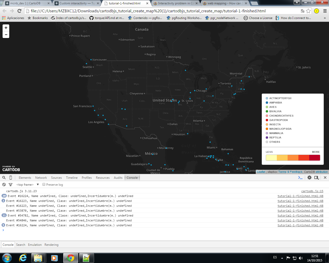
I have a problem with my interactivity and I can't solve alone. When mouse hover are on any point I would like show by console.log any column of my dataset.

With my code, only show me cartodb_id.

var map;
function init(){
  // initiate leaflet map
  map = new L.Map('cartodb-map', { 
    center: [40,-98],
    zoom: 4
  })

  L.tileLayer('https://dnv9my2eseobd.cloudfront.net/v3/cartodb.map-4xtxp73f/{z}/{x}/{y}.png', {
    attribution: 'Mapbox <a href="http://mapbox.com/about/maps" target="_blank">Terms &amp; Feedback</a>'
  }).addTo(map);

  var layerUrl = 'https://mcnb.cartodb.com/api/v2/viz/85aef586-5c57-11e5-9915-0e73ffd62169/viz.json';

  // change the query for the first layer
  var subLayerOptions = {
    sql: "SELECT * FROM mcnb_dev",
    cartocss: "#example_cartodbjs_1{marker-fill: #109DCD; marker-width: 5; marker-line-color: white; marker-line-width: 0;}"
  }

            
  cartodb.createLayer(map, layerUrl)
   .addTo(map)
   .on('done', function(layer) {
   
    layer.on('featureOver', function(e, pos, pixel, data) {
        // print data to console log
        
            console.log("Event #" + data.cartodb_id + ", Name " + data.name + ", Clase: " + data.class+ ",Incertidumbre(m.) " + data.coordinateuncertaintyinmeters );
          });
    
      // change the query for the first layer
      var subLayerOptions = {
          interactivity: "cartodb_id,class,coordinateuncertaintyinmeters",
          sql: "SELECT * FROM mcnb_dev",
          cartocss: "#example_cartodbjs_1{marker-fill: #109DCD; marker-width: 5; marker-line-color: white; marker-line-width: 0;}"
            }

      var sublayer = layer.getSubLayer(0);
      sublayer.set(subLayerOptions);

     // sublayer.infowindow.set('template', $('#infowindow_template').html());
            
      sublayer.on('featureClick', function(e, latlng, pos, data) {
              alert("Hey! You clicked " + data.cartodb_id);
        });
      
      }).on('error', function() {
            //log the error
    });
}  

SubLayer featureClick works but featureOver not.

Only show cartodb_id

Thanks a lot! Sorry for my english ;)