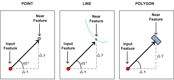
Try something like this.
- Use the Generate Near Table analysis function. This gets you the distance to the closest line on the Polygon as in your diagram.

- Join this information back to the the original points file.
- Build the new point based on the angle and the distance you now have in the original point layer. Something like this in the field calculator after adding an x1 and y1 (double) field.
You could then calculate the new point coordinates using the Field Calculator with two simple geometric expressions, one for X and another for Y.
x1 = x0 + distance*cos(bearing)
y1 = y0 + distance*sin(bearing)
- Create a new point shapefile based on x1 and y1 (add x,y data).
- Buffer the new points carrying across the original points ID.
- Use the original point ID in the buffer to join the buffer info back to the original points file.
For step 3 you could also create a line from the distance and angle and then convert the end to a point.
I am trying to coin a GIS phrase for this type of action "Create Shadow Points" and maybe later a tool with a handful of differing options (x & y offset and angle, on closest feature in direction x, and others). When you want to create one set of points from another with a 1-1 match and all that differs is the location of the second point, i.e the shadow.
