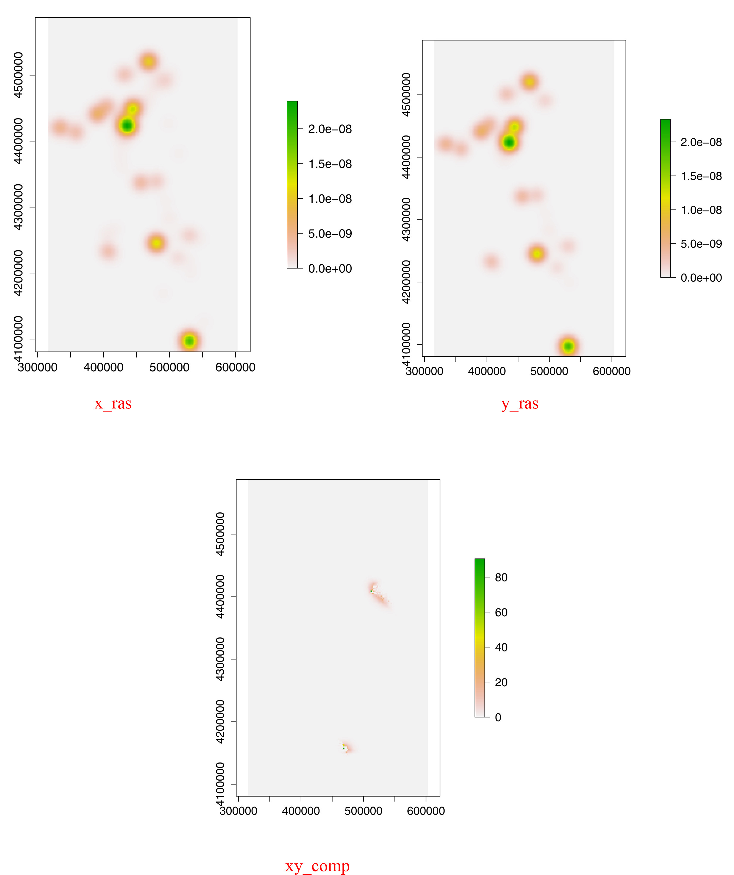
I have got a geographic point distribution with N prehistoric settlements with a size of x and want to compare the distribution with an economic simulation, which produces M settlements (Usally N > M). I've done about 110 runs with different parameters and now I'm looking for a best-fit model. Therefore I calculate the Kernel Density Estimation for the real settlemts (x_dens), the simulation results (y_dens) and for the M-biggest real settlements (xM_dens) and want to compare the cell values of two kernel density estimations in R.
As a first step, i am using the function density.ppp from the Package "spatstat".
x_dens <- density(x_ppp, sd, eps=rw, edge=TRUE, at="pixels")
x_ras <- raster(x_dens, crs="+proj=utm +zone=35 +ellps=WGS84 +datum=WGS84 +units=m +no_defs +towgs84=0,0,0")

y_dens <- density(y_ppp, sd, eps=rw, edge=TRUE, at="pixels")
y_ras <- raster(y_dens, crs="+proj=utm +zone=35 +ellps=WGS84 +datum=WGS84 +units=m +no_defs +towgs84=0,0,0")

xM_dens <- density(xM_ppp, sd, eps=rw, edge=TRUE, at="pixels")
xM_ras <- raster(xM_dens, crs="+proj=utm +zone=35 +ellps=WGS84 +datum=WGS84 +units=m +no_defs +towgs84=0,0,0")
The next step includes the calculation of the cell differences for x with xM, to see which would be minimum error for my M simulated settlements:
xxM_comp <- sqrt(((x_ras - xM_ras)^2 / x_ras))
xxM_comp [!is.finite(xxM_comp )] <- 0
xxM_comp_result <- sum(xxM_comp @data@values)
As a next step, i'm doing the same for my Y-simulated settlements:
xy_comp <- sqrt(((x_ras - y_ras)^2 / x_ras))
xy_comp [!is.finite(xy_comp )] <- 0
xy_comp_result <- sum(xy_comp @data@values)
To evaluate the best-fit model, i caluclate:
results <- xy_comp_results/xxM_comp_result
xy_comp shall result in a new raster layer, which shows the differences in both point pattern, but the resulting cell values are enormously high at some points and as a consequence xy_comp_result has a illogically high value. It is due to the fact, that some pixel values of x_ras much to small compared with y_ras. Do you have got any suggestions, how to solve this problem. I've tried to remove outliers, but I did not get proper results.
The methodology is described in D. Stelder, Where do Cities Form? A Geographical Agglomeration Model for Europa, Journal of Regional Science 45 (4), 2005, 657-679 (http://www.regroningen.nl/stelder/doc/JRS_nov2005_c.pdf) Starting with page 669.

