Improve notes, mention that elementarygeometries function requires a table as input.
Source Link
user30184
  • 69k
  • 4
  • 71
  • 125

Here is a step-wise process. Queries were made with Spatialite-gui and visualizations with OpenJUMP.

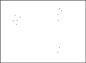
Take some points into table "points" with an attribute "radius".

enter image description here

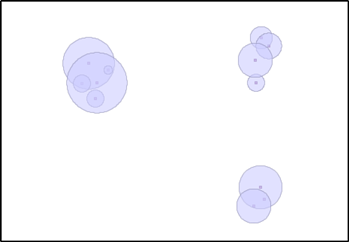
Buffer points by taking the radius from an attribute with SQL

CREATE TABLE "buffers" AS
SELECT ST_Buffer("geometry", "radius") as geometry FROM points;

enter image description here

Union the buffer areas with SQL

CREATE TABLE "combined" AS
SELECT ST_Union(geometry) as geometry FROM buffers;

enter image description here

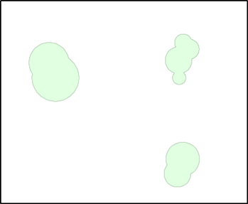
Union is one big multipolygon at this stage. Split it to three distinct geometries with SQL

SELECT ElementaryGeometries('combined', 'geometry', 'elements', 'ID', 'poly_ID');

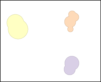
Have a look at the new table "elements"

enter image description here

The result is close to your sketch, isn't it?

Note: You must execute some additional SQL statements or use the tools of the spatialite-gui besides the ones I have written for registering the geometry columns of the interim tables. I hope my answer is complete enough for a proof of concept.

You can write ST_Union and ST_Buffer into same SQL but it is necessary to create a physical table "combined" and register it into geometry_columns for making ElementaryGeometries function to work.

Here is a step-wise process. Queries were made with Spatialite-gui and visualizations with OpenJUMP.

Take some points into table "points" with an attribute "radius".

enter image description here

Buffer points by taking the radius from an attribute with SQL

CREATE TABLE "buffers" AS
SELECT ST_Buffer("geometry", "radius") as geometry FROM points;

enter image description here

Union the buffer areas with SQL

CREATE TABLE "combined" AS
SELECT ST_Union(geometry) as geometry FROM buffers;

enter image description here

Union is one big multipolygon at this stage. Split it to three distinct geometries with SQL

SELECT ElementaryGeometries('combined', 'geometry', 'elements', 'ID', 'poly_ID');

Have a look at the new table "elements"

enter image description here

The result is close to your sketch, isn't it?

Note: You must execute some additional SQL statements or use the tools of the spatialite-gui besides the ones I have written for registering the geometry columns of the interim tables. I hope my answer is complete enough for a proof of concept.

You can write ST_Union and ST_Buffer into same SQL but it is necessary to create a physical table "combined" and register it into geometry_columns for making ElementaryGeometries function to work.
Source Link
user30184
  • 69k
  • 4
  • 71
  • 125

Here is a step-wise process. Queries were made with Spatialite-gui and visualizations with OpenJUMP.

Take some points into table "points" with an attribute "radius".

enter image description here

Buffer points by taking the radius from an attribute with SQL

CREATE TABLE "buffers" AS
SELECT ST_Buffer("geometry", "radius") as geometry FROM points;

enter image description here

Union the buffer areas with SQL

CREATE TABLE "combined" AS
SELECT ST_Union(geometry) as geometry FROM buffers;

enter image description here

Union is one big multipolygon at this stage. Split it to three distinct geometries with SQL

SELECT ElementaryGeometries('combined', 'geometry', 'elements', 'ID', 'poly_ID');

Have a look at the new table "elements"

enter image description here

The result is close to your sketch, isn't it?

Note: You must execute some additional SQL statements or use the tools of the spatialite-gui besides the ones I have written for registering the geometry columns of the interim tables. I hope my answer is complete enough for a proof of concept.