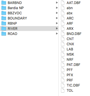
I was given some data sets to create maps in QGIS. Most of them were shape files, but some of them are in a formateformat I am not sure about what it is. For example it is a folder callescalled "Rivers", containing AAT.dbf, abs, abs, arc, ARF, ARX, BND.dbf, CNT, CNX, LAB, MSK, NRF and other files. Are these ArcInfo files? I am attaching a screenshot.
Could somebody help me how to open them in QGIS? Thank you very much! Eva

