have created database by tool osm2pgrouting. On my website can user enter start and end point.
How can I find ids of nodes? Because I have only text value of nodes which enter user, but tables generated by tool does not.
UPDATE:
On the website will be 2 inputs for 2 points (start and end) user enter for example New York (as start) and Los Angeles (as end). Next I call service to my geoserver and select route, and return tiles or geoJSON. But for selecting route I use pgr_dijkstra function which requires node IDs, but I have only NY and LA in text format. How can I convert this to coordinates or osm_id??
This
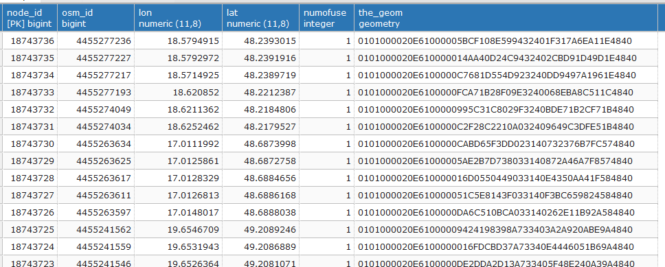
This is how my table of nodes looks:
This is reason why I need convert text values of user to id or coordinates. Thanks!

