added 11 characters in body; edited tags; edited title
Source Link
mgri
  • 16.3k
  • 6
  • 48
  • 80

Blank Base Map when exporting from Print Composer

When exporting from composer in QGIS to either an image or PDF the map does not print. I get a white page with only the shapefiles showing up.

This happens when the map is rotated 90 degrees. This only happens with maps from QuickMapServicesQuickMapServices plugin. If I load a raster image there are no issues.

Wondering if there is a way to get the QuickMapServices maps to show up when rotated 90 degrees?

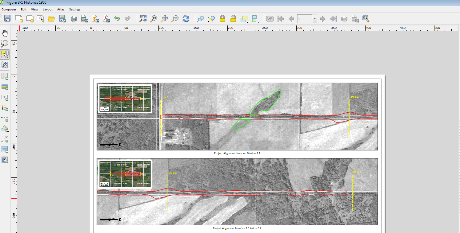
This is what the map looks like in composer: enter image description here

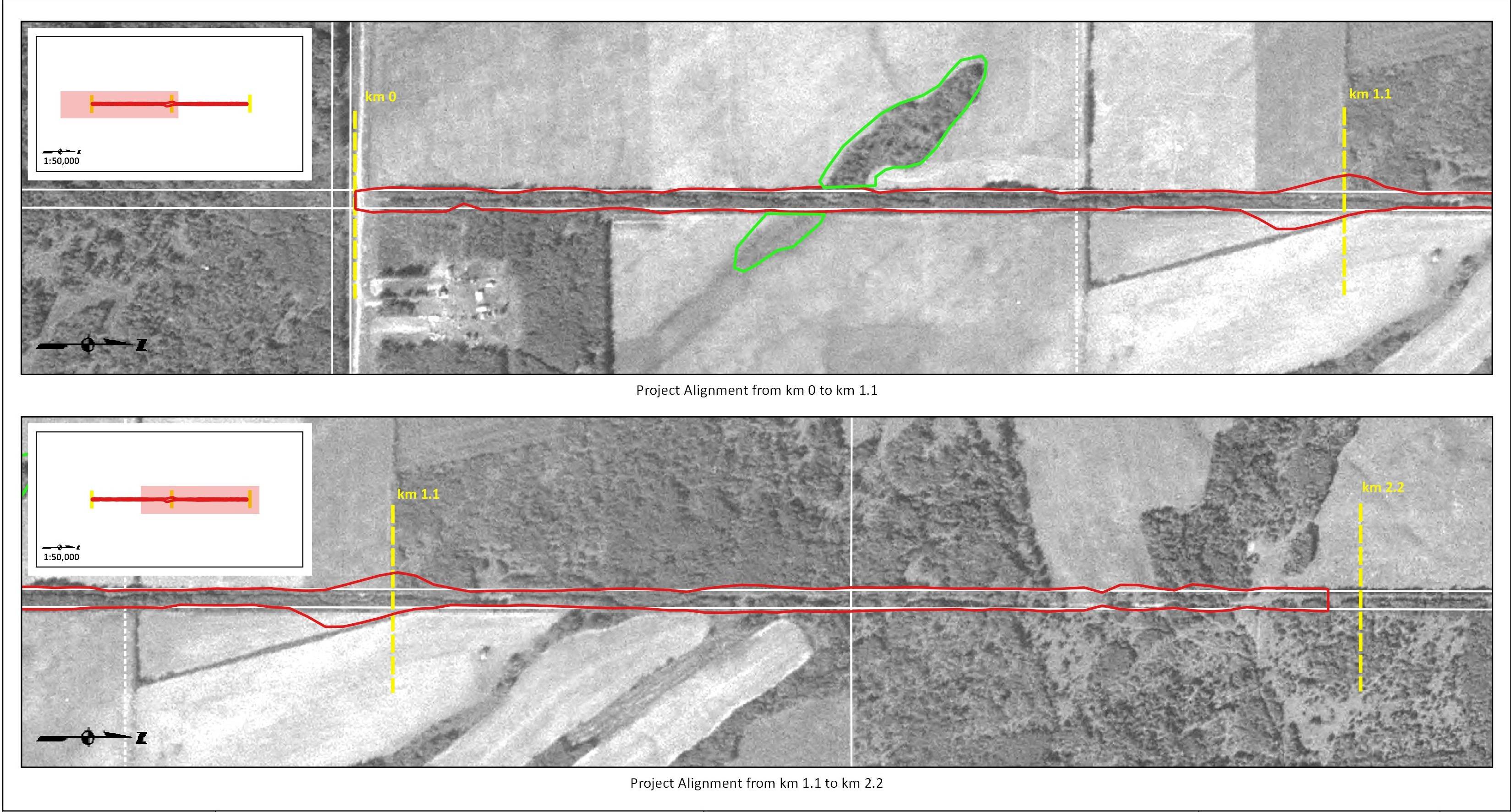
And this is what I get when I print the map enter image description here

Blank Base Map when exporting from Composer

When exporting from composer in QGIS to either an image or PDF the map does not print. I get a white page with only the shapefiles showing up.

This happens when the map is rotated 90 degrees. This only happens with maps from QuickMapServices. If I load a raster image there are no issues.

Wondering if there is a way to get the QuickMapServices maps to show up when rotated 90 degrees?

This is what the map looks like in composer: enter image description here

And this is what I get when I print the map enter image description here

Blank Base Map when exporting from Print Composer

When exporting from composer in QGIS to either an image or PDF the map does not print. I get a white page with only the shapefiles showing up.

This happens when the map is rotated 90 degrees. This only happens with maps from QuickMapServices plugin. If I load a raster image there are no issues.

Wondering if there is a way to get the QuickMapServices maps to show up when rotated 90 degrees?

This is what the map looks like in composer: enter image description here

And this is what I get when I print the map enter image description here

deleted 60 characters in body
Source Link

When exporting from composer in QGIS to either an image or PDF the map does not print. I get a white page with only the shapefiles showing up.

This happens when the scale of the image in the backgroundmap is greater than 1:30,000rotated 90 degrees. It does not seem to matter if this is an aerial photographThis only happens with maps from QuickMapServices. If I have added asload a raster or if I am using one of the maps from QucikMapServicesimage there are no issues.

Wondering how I canif there is a way to get the QuickMapServices maps to show up at a scale greater than 1:30,000when rotated 90 degrees?

This is what the map looks like in composer: enter image description here

And this is what I get when I print the map enter image description here

When exporting from composer in QGIS to either an image or PDF the map does not print. I get a white page with only the shapefiles showing up.

This happens when the scale of the image in the background is greater than 1:30,000. It does not seem to matter if this is an aerial photograph I have added as a raster or if I am using one of the maps from QucikMapServices.

Wondering how I can get the maps to show up at a scale greater than 1:30,000?

This is what the map looks like in composer: enter image description here

And this is what I get when I print the map enter image description here

When exporting from composer in QGIS to either an image or PDF the map does not print. I get a white page with only the shapefiles showing up.

This happens when the map is rotated 90 degrees. This only happens with maps from QuickMapServices. If I load a raster image there are no issues.

Wondering if there is a way to get the QuickMapServices maps to show up when rotated 90 degrees?

This is what the map looks like in composer: enter image description here

And this is what I get when I print the map enter image description here

Post Reopened by Michael Stimson, Andre Silva, Fezter
added 299 characters in body
Source Link

When tryingexporting from composer in QGIS to exporteither an image or PDF from composer in QGIS the base map does not appearprint. I am using geo-referenced historical air photos and when I have a map over a certain scale all I get is a blank map. All ofwhite page with only the shapefiles print but the air photo does not appearshowing up. 

This seems to happen with anything overhappens when the scale of the image in the background is greater than 1:3530,000 for black and white and. It does not seem to matter if this is an aerial photograph I have added as a raster or if I am using one of the maps from QucikMapServices.

Wondering how I can get the maps to show up at a scale greater than 1:2030,000 for colour. Is there a reason?

This is what the map will not print abovelooks like in composer: enter image description here
And this scale?is what I get when I print the map enter image description here
When trying to export an image or PDF from composer in QGIS the base map does not appear. I am using geo-referenced historical air photos and when I have a map over a certain scale all I get is a blank map. All of the shapefiles print but the air photo does not appear. This seems to happen with anything over 1:35,000 for black and white and 1:20,000 for colour. Is there a reason the map will not print above this scale?

When exporting from composer in QGIS to either an image or PDF the map does not print. I get a white page with only the shapefiles showing up. 

This happens when the scale of the image in the background is greater than 1:30,000. It does not seem to matter if this is an aerial photograph I have added as a raster or if I am using one of the maps from QucikMapServices.

Wondering how I can get the maps to show up at a scale greater than 1:30,000?

This is what the map looks like in composer: enter image description here

And this is what I get when I print the map enter image description here

Post Closed as "Needs details or clarity" by mgri, John Powell, Ian Turton
Source Link
Loading