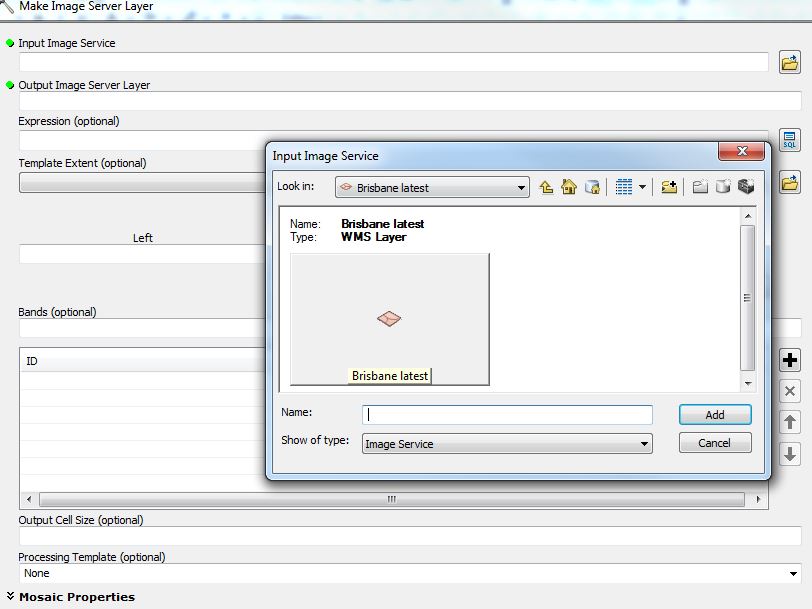
I have a subscription to Nearmap that provides me with WMS Server link to their images. I would like to perform image classification using this imagery however I can't work out how to use the WMS feed for classification in ArcGiS (v10.3.1) short of exporting a series of maps as a raster.
I've tried Arc's "make image server layer" tool however I can't seem to select an image service layer. I get to the point in the attached image and can't select anything.
Does anyone know how I do this?
Thank you!

