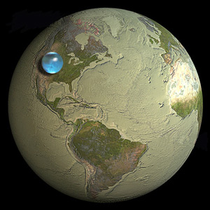
I happened to read a USGS article, How much water is there on, in, and above the Earth? showing a representation of all the water(which includes water from Oceans, Seas,Bays,Ice caps, Glaciers, Permanent Snow and ground water) displayed as a small sphere as shown below.

I find it hard to believe although the site has given good statistics for it. Is this a correct representation or is it a map gone wrong?
