added 250 characters in body
Source Link

I'm downloading a point-dataset as an x,y,depth .csv-file. I'd like to interpolate these and use them as an nautical navigational chart. The problem arises on interpolating the points into a raster (image below). The dataset also contains islands and parts ashore. I'd like to have a method which sort of clips the raster if no points are in the neighborhood. Even better would be a method which doesn't interpolate at these areas.

enter image description here

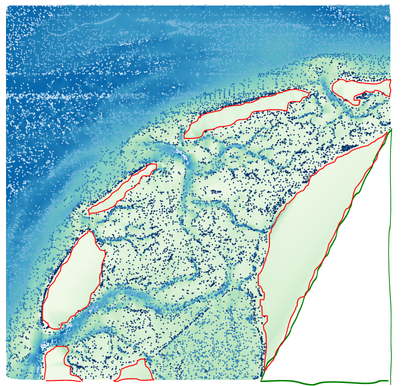
In the figure below, I indicated the part in green which yields the perfect result: no interpolation and thus no_data. The parts in red indicate the areas which I want to get rid of. Is there a good method or workflow to yield this desird result?

enter image description here

Edit:
Here is a small sample dataset without islands. I'm still preparing a set with islands in it. Samples

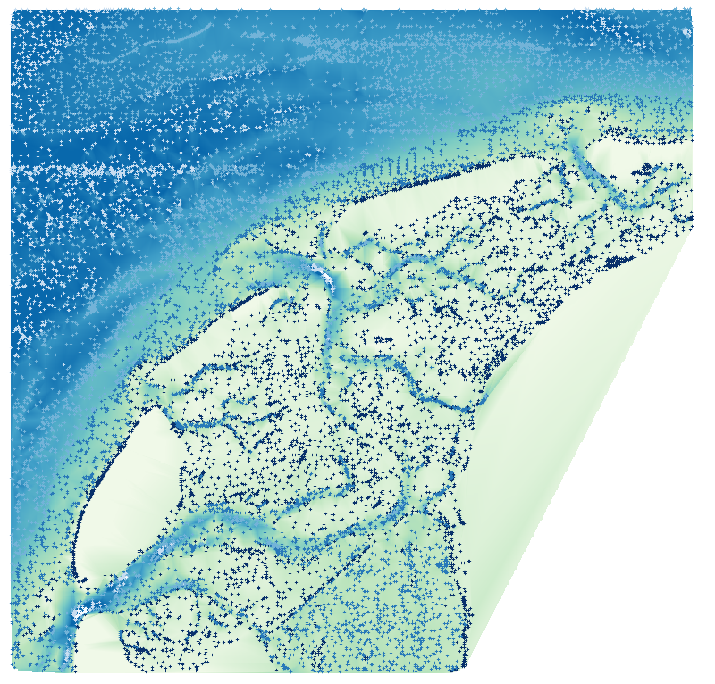
I'm downloading a point-dataset as an x,y,depth .csv-file. I'd like to interpolate these and use them as an nautical navigational chart. The problem arises on interpolating the points into a raster (image below). The dataset also contains islands and parts ashore. I'd like to have a method which sort of clips the raster if no points are in the neighborhood. Even better would be a method which doesn't interpolate at these areas.

enter image description here

In the figure below, I indicated the part in green which yields the perfect result: no interpolation and thus no_data. The parts in red indicate the areas which I want to get rid of. Is there a good method or workflow to yield this desird result?

enter image description here

Edit:
Here is a small sample dataset without islands. I'm still preparing a set with islands in it. Samples
edited tags; edited title
Link
PolyGeo
  • 65.4k
  • 29
  • 114
  • 345

Clip Clipping raster by points in QGIS?

deleted 11 characters in body
Source Link

I'm downloading a point-dataset as an x,y,depth .csv-file. I'd like to interpolate these and use them as an nautical navigational chart. The problem arises on interpolating the points into a raster (image below). The dataset also contains islands and parts ashore. I'd like to have a method which sort of clips the raster if no points are in the neighborhood. Even better would be a method which doesn't interpolate at these areas.

enter image description here

In the figure below, I indicated the part in green which yields the perfect result: no interpolation and thus no_data. The parts in red indicate the areas which I want to get rid of: no_data. Is there a good method or workflow to yield this desird result?

enter image description here

I'm downloading a point-dataset as an x,y,depth .csv-file. I'd like to interpolate these and use them as an nautical navigational chart. The problem arises on interpolating the points into a raster (image below). The dataset also contains islands and parts ashore. I'd like to have a method which sort of clips the raster if no points are in the neighborhood. Even better would be a method which doesn't interpolate at these areas.

enter image description here

In the figure below, I indicated the part in green which yields the perfect result: no interpolation and thus no_data. The parts in red indicate the areas which I want to get rid of. Is there a good method or workflow to yield this desird result?

enter image description here

Source Link
Loading