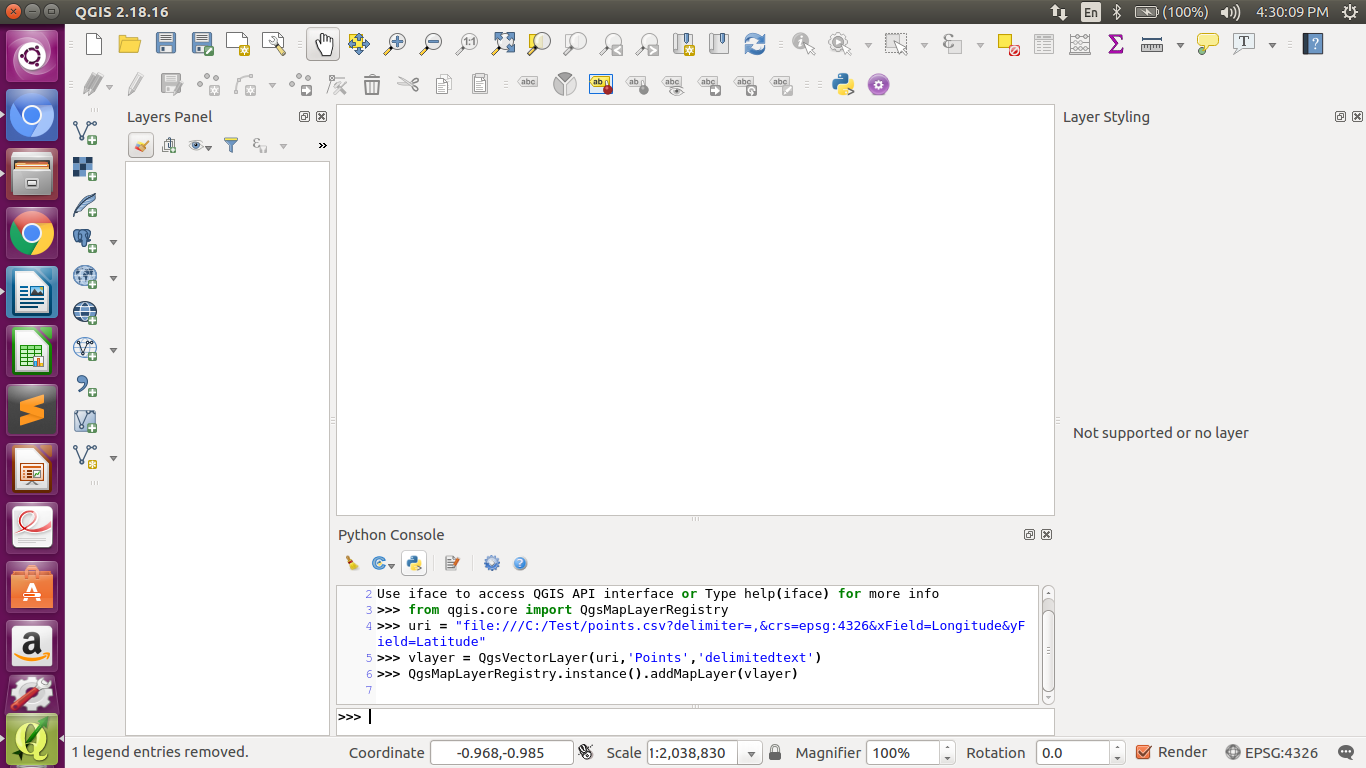
added 85 characters in body
Source Link
ps1
  • 607
  • 5
  • 18

Ienter image description hereI have a CSV file with following fields:

  • Nodename
  • Nodeid
  • Latitude
  • Longtitude
  • Elevation

I am using Python console in QGIS to automate this. How should I write so that point with latitude, longtitude and elevation are maked as point layer? I have tried with below code, but I am getting error.

uri = "/home/priti/Desktop/MTP work/nodeinput.csv?\
type=csv&xField=Longtitude\
&yField=Lattitude\
&spatialIndex=no&subsetIndex=no&watchFile=no"

vlayer = QgsVectorLayer(uri, 'Nodes', "delimitedtext")


I have a CSV file with following fields:

  • Nodename
  • Nodeid
  • Latitude
  • Longtitude
  • Elevation

I am using Python console in QGIS to automate this. How should I write so that point with latitude, longtitude and elevation are maked as point layer? I have tried with below code, but I am getting error.

uri = "/home/priti/Desktop/MTP work/nodeinput.csv?\
type=csv&xField=Longtitude\
&yField=Lattitude\
&spatialIndex=no&subsetIndex=no&watchFile=no"

vlayer = QgsVectorLayer(uri, 'Nodes', "delimitedtext")


enter image description hereI have a CSV file with following fields:

  • Nodename
  • Nodeid
  • Latitude
  • Longtitude
  • Elevation

I am using Python console in QGIS to automate this. How should I write so that point with latitude, longtitude and elevation are maked as point layer? I have tried with below code, but I am getting error.

uri = "/home/priti/Desktop/MTP work/nodeinput.csv?\
type=csv&xField=Longtitude\
&yField=Lattitude\
&spatialIndex=no&subsetIndex=no&watchFile=no"

vlayer = QgsVectorLayer(uri, 'Nodes', "delimitedtext")

   
removed please help and newness
Source Link
Vince
  • 20.3k
  • 16
  • 48
  • 65

Importing CSV file to create Point Layerpoint layer

I have a csvCSV file with following fields:

  • Nodename
  • Nodeid
  • Latitude
  • Longtitude
  • Elevation

I am using pythonPython console in QGIS to automate this. How should iI write so that point with latitude, longtitude and elevation are maked as point layer ?? I have tried with below code, but i amI am getting error. I am completely new to this . please help me out !!

uri = "/home/priti/Desktop/MTP work/nodeinput.csv?\
type=csv&xField=Longtitude\
&yField=Lattitude\
&spatialIndex=no&subsetIndex=no&watchFile=no"

vlayer = QgsVectorLayer(uri, 'Nodes', "delimitedtext")


Importing CSV file to create Point Layer

I have a csv file with following fields:

  • Nodename
  • Nodeid
  • Latitude
  • Longtitude
  • Elevation

I am using python console in QGIS to automate this. How should i write so that point with latitude, longtitude and elevation are maked as point layer ?? I have tried with below code, but i am getting error. I am completely new to this . please help me out !!

uri = "/home/priti/Desktop/MTP work/nodeinput.csv?\
type=csv&xField=Longtitude\
&yField=Lattitude\
&spatialIndex=no&subsetIndex=no&watchFile=no"

vlayer = QgsVectorLayer(uri, 'Nodes', "delimitedtext")


Importing CSV file to create point layer

I have a CSV file with following fields:

  • Nodename
  • Nodeid
  • Latitude
  • Longtitude
  • Elevation

I am using Python console in QGIS to automate this. How should I write so that point with latitude, longtitude and elevation are maked as point layer? I have tried with below code, but I am getting error.

uri = "/home/priti/Desktop/MTP work/nodeinput.csv?\
type=csv&xField=Longtitude\
&yField=Lattitude\
&spatialIndex=no&subsetIndex=no&watchFile=no"

vlayer = QgsVectorLayer(uri, 'Nodes', "delimitedtext")

   
deleted 18 characters in body
Source Link
Kadir Şahbaz
  • 78k
  • 57
  • 257
  • 404

I have a csv file with following fields:

  • Nodename
  • Nodeid
  • Latitude
  • Longtitude
  • Elevation

I am using python console in QGIS to automate this. How should i write so that point with latitude, longtitude and elevation are maked as point layer ?? I have tried with below code, but i am getting error. I am completely new to this . please help me out !!

uri = "/home/priti/Desktop/MTP work/nodeinput.csv? \
       type=csv&xField=Longtitudetype=csv&xField=Longtitude\
       &yField=Lattitude &yField=Lattitude\
       &spatialIndex=no&subsetIndex=no&watchFile=no" 

vlayer = QgsVectorLayer(uri, 'Nodes', "delimitedtext")


I have a csv file with following fields:

  • Nodename
  • Nodeid
  • Latitude
  • Longtitude
  • Elevation

I am using python console in QGIS to automate this. How should i write so that point with latitude, longtitude and elevation are maked as point layer ?? I have tried with below code, but i am getting error. I am completely new to this . please help me out !!

uri = "/home/priti/Desktop/MTP work/nodeinput.csv? 
       type=csv&xField=Longtitude
       &yField=Lattitude 
       &spatialIndex=no&subsetIndex=no&watchFile=no"
vlayer = QgsVectorLayer(uri, 'Nodes', "delimitedtext")


I have a csv file with following fields:

  • Nodename
  • Nodeid
  • Latitude
  • Longtitude
  • Elevation

I am using python console in QGIS to automate this. How should i write so that point with latitude, longtitude and elevation are maked as point layer ?? I have tried with below code, but i am getting error. I am completely new to this . please help me out !!

uri = "/home/priti/Desktop/MTP work/nodeinput.csv?\
type=csv&xField=Longtitude\
&yField=Lattitude\
&spatialIndex=no&subsetIndex=no&watchFile=no" 

vlayer = QgsVectorLayer(uri, 'Nodes', "delimitedtext")

   
added csv tag, formatted code
Source Link
Kadir Şahbaz
  • 78k
  • 57
  • 257
  • 404
Loading
edited tags
Link
ps1
  • 607
  • 5
  • 18
Loading
added 18 characters in body; edited tags
Source Link
Bera
  • 77.9k
  • 14
  • 78
  • 188
Loading
Source Link
ps1
  • 607
  • 5
  • 18
Loading