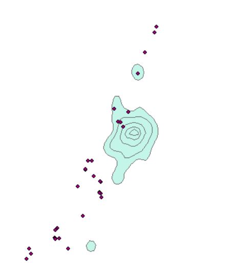
I have location data points for colonies (csv file). I have a shapefile that I need to duplicate and georeference to each colony. Is there a way to do this in r?
EDIT: I want to create a copy of the existing KUD shapefile for each colony location. I do not want to create a unique KUD for each colony.
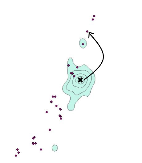
Picture shows the shapefile (green) that I am trying to replicate for each colony and have the center of the shapefile georeferenced to on the colony. Arrows show the change I want to make in the location of the shapefile.
Picture shows the data table of the colonies. They are imported as a csv file and I need to create a copy of the shapefile for each colony data point located at the same lat/lon.


