added 208 characters in body
Source Link
Martina
  • 123
  • 5

I have added a layer with tracks and track points from OSM in QQGIS and exported this GPX file into an shapefile. Now I wanted to calculated the area of the buildings. I tried to do this with the tracks which also distribute the outlines of the different buidlings. But the function $area did not work in the attribute table. So how can I get the GPX file or shape file with tracks and trackpoints into a layer with polygons?

enter image description here

This a picture of the track and trackpoint layer. I need the areas of all buildings to do a furter calculations.

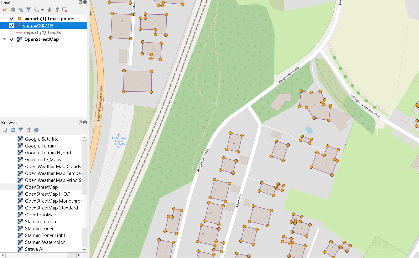
I have added a layer with tracks and track points from OSM in QQGIS and exported this GPX file into an shapefile. Now I wanted to calculated the area of the buildings. I tried to do this with the tracks which also distribute the outlines of the different buidlings. But the function $area did not work in the attribute table. So how can I get the GPX file or shape file with tracks and trackpoints into a layer with polygons?

I have added a layer with tracks and track points from OSM in QQGIS and exported this GPX file into an shapefile. Now I wanted to calculated the area of the buildings. I tried to do this with the tracks which also distribute the outlines of the different buidlings. But the function $area did not work in the attribute table. So how can I get the GPX file or shape file with tracks and trackpoints into a layer with polygons?

enter image description here

This a picture of the track and trackpoint layer. I need the areas of all buildings to do a furter calculations.

naming; tyop
Source Link
Vince
  • 20.3k
  • 16
  • 48
  • 65

I have added a layer with tracks and track points from OSM in QQGIS and exported this GPX file into an shape fileshapefile. Now I wanted to calculated the area of the buildings. I tried to do this with the tracks which also distributdistribute the outlines of the different buidlings. But the function $area did not work in the attribute table. So how can I get the GPX file or shape file with tracks and trackpoints into a layer with polygons?

I have added a layer with tracks and track points from OSM in QQGIS and exported this GPX file into an shape file. Now I wanted to calculated the area of the buildings. I tried to do this with the tracks which also distribut the outlines of the different buidlings. But the function $area did not work in the attribute table. So how can I get the GPX file or shape file with tracks and trackpoints into a layer with polygons?

I have added a layer with tracks and track points from OSM in QQGIS and exported this GPX file into an shapefile. Now I wanted to calculated the area of the buildings. I tried to do this with the tracks which also distribute the outlines of the different buidlings. But the function $area did not work in the attribute table. So how can I get the GPX file or shape file with tracks and trackpoints into a layer with polygons?

Source Link
Martina
  • 123
  • 5

Polygons out of a shapefile in QGIS

I have added a layer with tracks and track points from OSM in QQGIS and exported this GPX file into an shape file. Now I wanted to calculated the area of the buildings. I tried to do this with the tracks which also distribut the outlines of the different buidlings. But the function $area did not work in the attribute table. So how can I get the GPX file or shape file with tracks and trackpoints into a layer with polygons?