Tweeted twitter.com/StackGIS/status/1160385789244727298
added 4 characters in body
Source Link
Jochen Schwarze
  • 14.9k
  • 8
  • 54
  • 120

I would like to recreate the style in this Wikipedia Locator map, where there are three distinct styles for boundaries:

  1. Coastline (thin blue line)
  2. High-level administrative land-border (thick grey line)
  3. Low-level administrative land-border (thin grey line) Wikipedia style Locator map, from https://en.wikipedia.org/wiki/File:France_location_map.svg
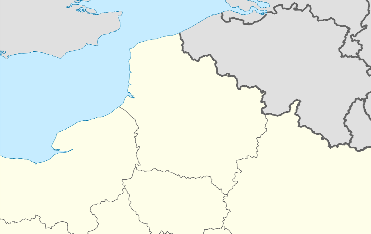
Wikipedia style Locator map, from https://en.wikipedia.org/wiki/File:France_location_map.svg

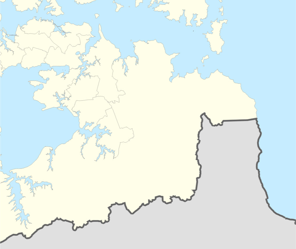
I have high and low level administrative units for my area of interest, as polygons. I have tried to match the style as closely as possible:   

enter image description here

However, I have no way to distinguish coast-line from land-border. Adding a new coastline polygon would allow me to add a blue line along the coast, but I would still have the grey lines along the coast.

I think that the next step would be to extract only the land-borders from the polygons, but I'm not sure how to do so, other than manually snipping the line wherever it reaches the coast.

Is there a way to 'detect shared boundaries'? Ideally using Processing Toolbox, GRASS, or a QGIS3 Plugin. I am learning to use PyQGIS so would be able to try with that also.

Edit: I have just seen this question: Converting polygon to lines without duplicate edges? It appears what I am trying to do is work with a 'planar graph', which was achieved by using OpenJump.

I would like to recreate the style in this Wikipedia Locator map, where there are three distinct styles for boundaries:

  1. Coastline (thin blue line)
  2. High-level administrative land-border (thick grey line)
  3. Low-level administrative land-border (thin grey line) Wikipedia style Locator map, from https://en.wikipedia.org/wiki/File:France_location_map.svg

I have high and low level administrative units for my area of interest, as polygons. I have tried to match the style as closely as possible:  enter image description here

However, I have no way to distinguish coast-line from land-border. Adding a new coastline polygon would allow me to add a blue line along the coast, but I would still have the grey lines along the coast.

I think that the next step would be to extract only the land-borders from the polygons, but I'm not sure how to do so, other than manually snipping the line wherever it reaches the coast.

Is there a way to 'detect shared boundaries'? Ideally using Processing Toolbox, GRASS, or a QGIS3 Plugin. I am learning to use PyQGIS so would be able to try with that also.

Edit: I have just seen this question: Converting polygon to lines without duplicate edges? It appears what I am trying to do is work with a 'planar graph', which was achieved by using OpenJump.

I would like to recreate the style in this Wikipedia Locator map, where there are three distinct styles for boundaries:

  1. Coastline (thin blue line)
  2. High-level administrative land-border (thick grey line)
  3. Low-level administrative land-border (thin grey line)

Wikipedia style Locator map, from https://en.wikipedia.org/wiki/File:France_location_map.svg

I have high and low level administrative units for my area of interest, as polygons. I have tried to match the style as closely as possible: 

enter image description here

However, I have no way to distinguish coast-line from land-border. Adding a new coastline polygon would allow me to add a blue line along the coast, but I would still have the grey lines along the coast.

I think that the next step would be to extract only the land-borders from the polygons, but I'm not sure how to do so, other than manually snipping the line wherever it reaches the coast.

Is there a way to 'detect shared boundaries'? Ideally using Processing Toolbox, GRASS, or a QGIS3 Plugin. I am learning to use PyQGIS so would be able to try with that also.

Edit: I have just seen this question: Converting polygon to lines without duplicate edges? It appears what I am trying to do is work with a 'planar graph', which was achieved by using OpenJump.

edited tags
Link
PolyGeo
  • 65.4k
  • 29
  • 114
  • 345
Added link to similar question
Source Link
TimD
  • 439
  • 4
  • 11

I would like to recreate the style in this Wikipedia Locator map, where there are three distinct styles for boundaries:

  1. Coastline (thin blue line)
  2. High-level administrative land-border (thick grey line)
  3. Low-level administrative land-border (thin grey line) Wikipedia style Locator map, from https://en.wikipedia.org/wiki/File:France_location_map.svg

I have high and low level administrative units for my area of interest, as polygons. I have tried to match the style as closely as possible: enter image description here

However, I have no way to distinguish coast-line from land-border. Adding a new coastline polygon would allow me to add a blue line along the coast, but I would still have the grey lines along the coast.

I think that the next step would be to extract only the land-borders from the polygons, but I'm not sure how to do so, other than manually snipping the line wherever it reaches the coast.

Is there a way to 'detect shared boundaries'? Ideally using Processing Toolbox, GRASS, or a QGIS3 Plugin. I am learning to use PyQGIS so would be able to try with that also.

Edit: I have just seen this question: Converting polygon to lines without duplicate edges? It appears what I am trying to do is work with a 'planar graph', which was achieved by using OpenJump.

I would like to recreate the style in this Wikipedia Locator map, where there are three distinct styles for boundaries:

  1. Coastline (thin blue line)
  2. High-level administrative land-border (thick grey line)
  3. Low-level administrative land-border (thin grey line) Wikipedia style Locator map, from https://en.wikipedia.org/wiki/File:France_location_map.svg

I have high and low level administrative units for my area of interest, as polygons. I have tried to match the style as closely as possible: enter image description here

However, I have no way to distinguish coast-line from land-border. Adding a new coastline polygon would allow me to add a blue line along the coast, but I would still have the grey lines along the coast.

I think that the next step would be to extract only the land-borders from the polygons, but I'm not sure how to do so, other than manually snipping the line wherever it reaches the coast.

Is there a way to 'detect shared boundaries'? Ideally using Processing Toolbox, GRASS, or a QGIS3 Plugin. I am learning to use PyQGIS so would be able to try with that also.

Edit: I have just seen this question: Converting polygon to lines without duplicate edges? It appears what I am trying to do is work with a 'planar graph', which was achieved by using OpenJump.

Source Link
TimD
  • 439
  • 4
  • 11
Loading