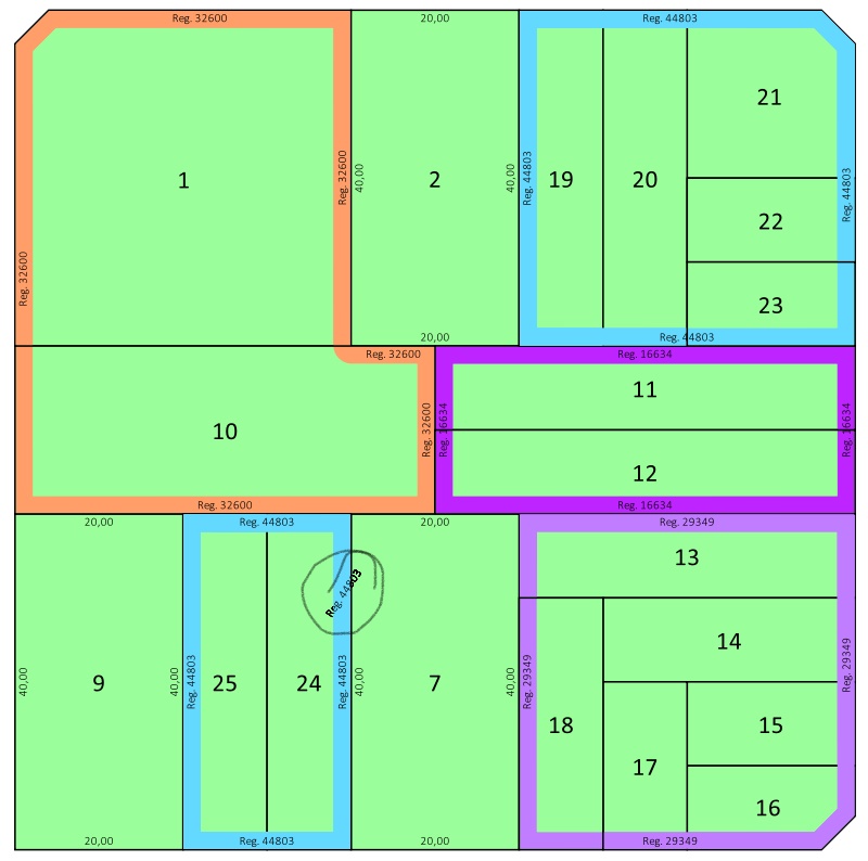
Title says it all.. I combined a set of polygons on the first instance of Geometry generator using something like this:
buffer(buffer(collect( $geometry, concat("MZNA","REGLABEL")), 0.1), -0.1)
Buffers are meant to join poligons with a little separation. Thing is, after that I defined marker lines to simulate measurement, but in the case of multipart polygons, I get random measures floating between the different 'islands'. So I want to separate them before measuring, but I dont know how...
Im using the approach shownin Labeling each individual side of polygon in QGIS by @she_weeds. My problem is, as shown in the pic, after collecting and buffering, I get some multipolygons and those ones gets an extra text floating between the polygon parts. Is there a way to avoid it without dissolving the generated geometry? Im
Im not experienced enough to know if its possible to test each line(started using QGis 2 weeks ago), for examplebut i thought some options:
- Dissolve polygons instead of collecting them, using a python function. Didnt know how to call dissolve from the function editor, didn't even know if it was possible.
- Apply a filter to the collect statement.
- When generating lines from points, or text from those lines, somehow test the points to condition the generation of lines.
- When generating points from nodes, test multipart polygons and generate different sets of points. Managed to successfully test that but didnt manage to create more than one set of points.

