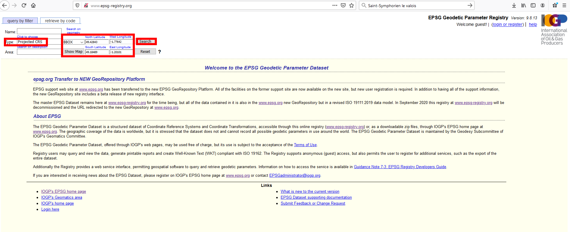
You did not state from which area your file is, but your coordinates show that it is in the northwest of France. So what I did is looking for the exact location that the sample coordinates in your post refer to. Then I used this tool to see which Coordinate Reference Systems (CRS) are valid for this area: http://www.epsg-registry.org/
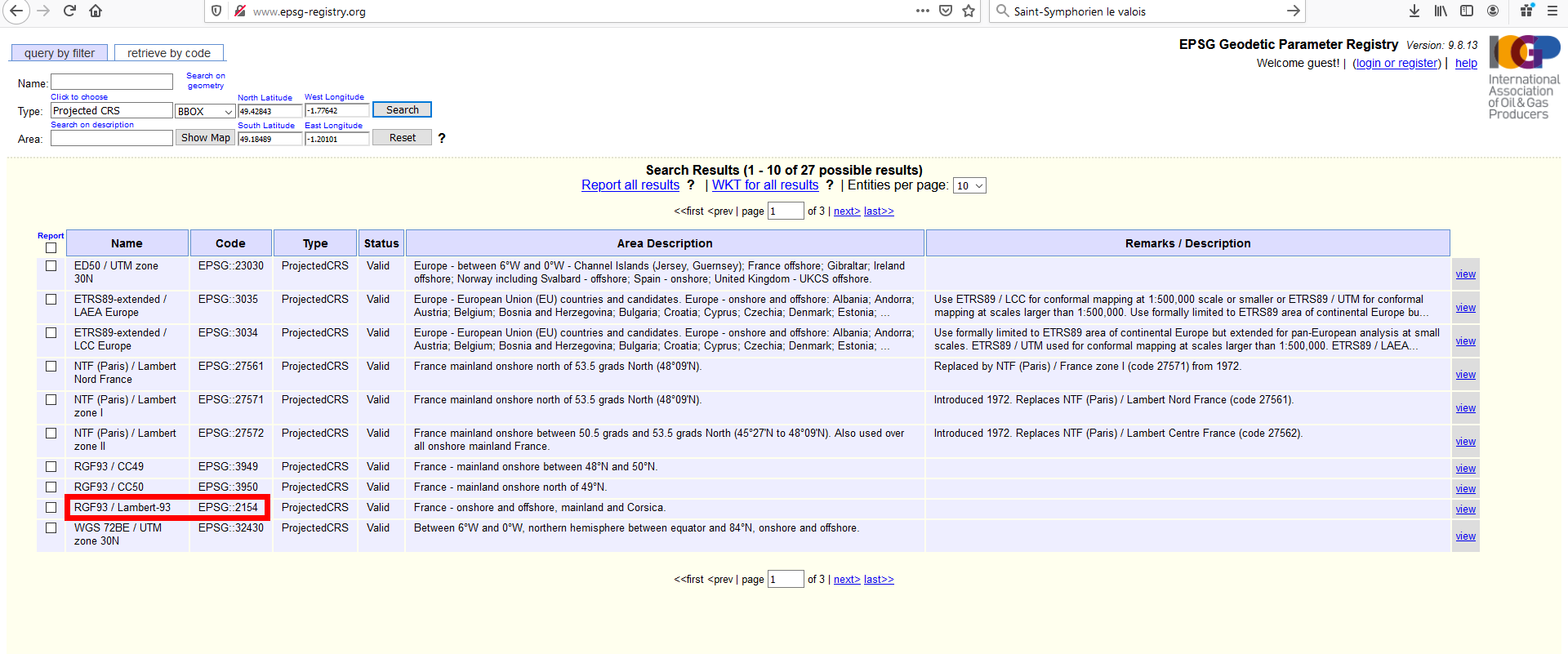
I zoomed in on the map to the area of interest and defined a projected CRS (because the coordinates in your file are apparently defined in a projected CRS). The resulting list had a few CRS valid for this region.
The ogr:XL93-tag in your file is a hint that it should be one of the CRS containing the number 93. So in QGIS, I loaded your gpx-File and an OpenStreetMap basemap and than assigned the CRS-codes from the result to the gpx-layer (right click on layer, set CRS, set CRS for layer). After a few attemtps (zoom to layer after each operation of setting CRS), it resulted that your path is shown correctly with this CRS: RGF93 / Lambert-93 EPSG::2154
So now I just had to export your gpx to a new gpx file, but this time (attention) select 4326 as CRS for the file to get standard GPS-coordinates. You can download the file from here: https://drive.switch.ch/index.php/s/eIaUTYymGpLFXL7 I tested it in Google Maps, works correctly there.
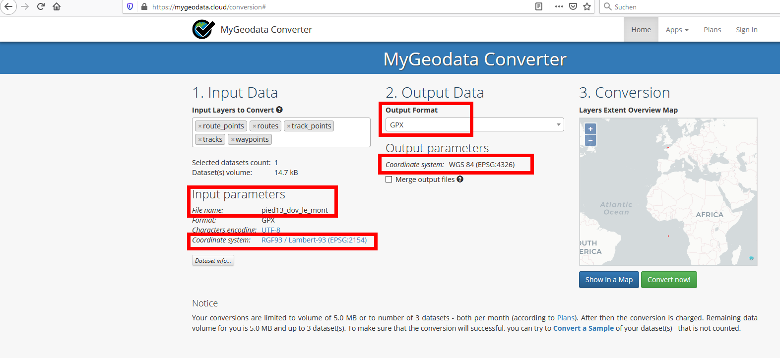
Update: There is an online tool to convert your gpx files, if you have more than just this one: https://mygeodata.cloud/converter/gpx-to-latlong Upload your file and than set the parameters accordingly (pay attention especially to choose the correct CRS for your input file and be sure to set CRS to 4326 for your export file):


