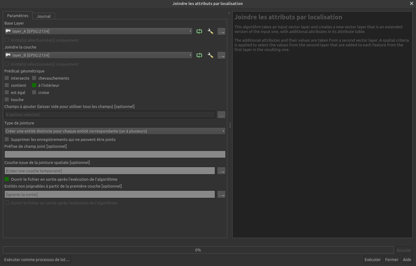
You can use the tool join attributes by location :
https://docs.qgis.org/3.10/en/docs/user_manual/processing_algs/qgis/vectorgeneral.html#join-attributes-by-location
He is located in the tab Vector -> Data Management Tool
It allows you to choose 2 layers and the spatial relation to join attribute from one layer to the other (intersect, touches, within, etc...). You can also choose the column to join.
In the pictue layer_A will be your municipalities, layer_B your Hydrological Regions and the Geometric predicate is within. So every municipalities obtain the ID of the Hydrological Regions they are in.

