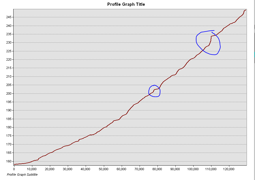
My goal is to generate points along my stream centerline at any positive inflection points (0.5 feet in elevation or greater). II used a Water Surface Grid (Raster) to convert my stream centerlines to 3D using the Interpolate Shape tool.
Looking at my stream in profile view, here are some examples of where I'd like to create points:
I posted a similar question before, but this script compares absolute difference between any two vertices and does not capture inflection points. Create points along 3D stream where elevation changes by 1ft
My idea is to store the starting value then look at the next vertex, if less than 0.5, skip and move onto the next vertex. Continue this till I hit a vertex that is 0.5 or greater from the starting point. Then create a point at this vertex. Then, move on and find the next jump of 0.5 or more.
Does someone have any ideas on how to script this out using arcpyArcPy & pythonPython 3?

