naming; English usage
Source Link
Vince
  • 20.3k
  • 16
  • 48
  • 65

I have geojsonGeoJSON multipoint layer and would like to create a line network (geojsonGeoJSON multiline) out of it. Best case the points would be snapped to a road. I have only coordinates and no additional information for these points.

enter image description here

I've tried to use QGIS "Points to path" tool, but i have no order for the points, so that's not really the result I'm looking for.

I think the steps would be something like this:

  • Remove points that are close to each other
  • Extract street layer from OSM
  • Snap points to streets
  • connectConnect closest points

I don't really know where to start and what tools to use for this.

I have geojson multipoint layer and would like to create a line network (geojson multiline) out of it. Best case the points would be snapped to a road. I have only coordinates and no additional information for these points.

enter image description here

I've tried to use QGIS "Points to path" tool, but i have no order for the points, so that's not really the result I'm looking for.

I think the steps would be something like this:

  • Remove points that are close to each other
  • Extract street layer from OSM
  • Snap points to streets
  • connect closest points

I don't really know where to start and what tools to use for this.
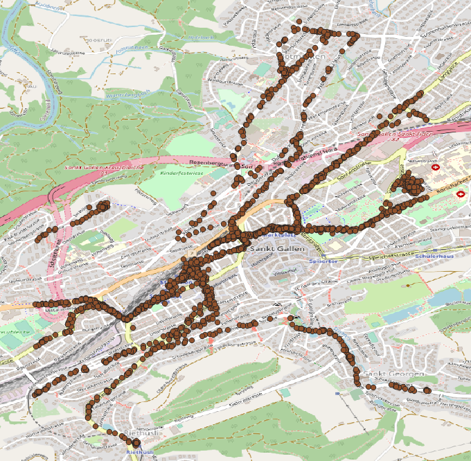
I have GeoJSON multipoint layer and would like to create a line network (GeoJSON multiline) out of it. Best case the points would be snapped to a road. I have only coordinates and no additional information for these points.

enter image description here

I've tried to use QGIS "Points to path" tool, but i have no order for the points, so that's not really the result I'm looking for.

I think the steps would be something like this:

  • Remove points that are close to each other
  • Extract street layer from OSM
  • Snap points to streets
  • Connect closest points

I don't really know where to start and what tools to use for this.

edited title
Link
Bera
  • 77.8k
  • 14
  • 78
  • 188

Create Roadnetwork form Pointsroad network from points

Source Link

Create Roadnetwork form Points

I have geojson multipoint layer and would like to create a line network (geojson multiline) out of it. Best case the points would be snapped to a road. I have only coordinates and no additional information for these points.

enter image description here

I've tried to use QGIS "Points to path" tool, but i have no order for the points, so that's not really the result I'm looking for.

I think the steps would be something like this:

  • Remove points that are close to each other
  • Extract street layer from OSM
  • Snap points to streets
  • connect closest points

I don't really know where to start and what tools to use for this.