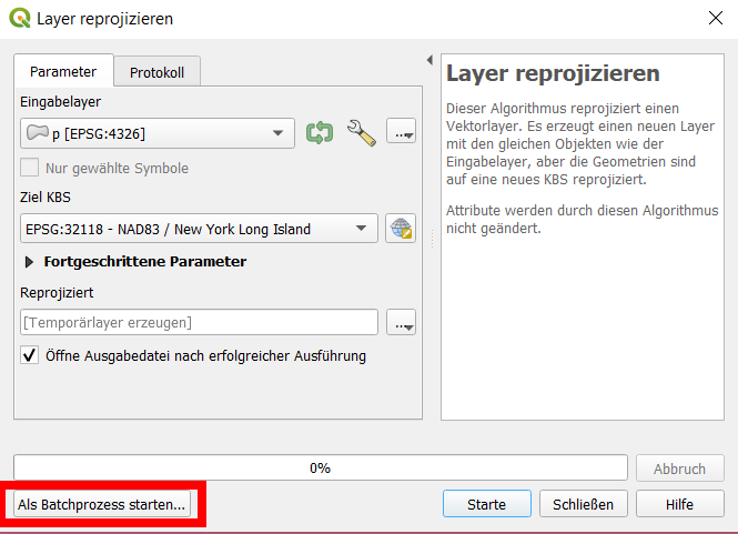
Do NOT "change" the CRS: what. When you did isRight-click layer > Layer CRS > Set Layer CRS..., you simply assigning another CRS definition to your layer. HoweverYou should never do that if you're not 100% sure about what you do.
This option is only for the case if the layer's CRS is somehow not correctly recognized - then you have to manually tell QGIS which CRS the layer was initially created in. You have to know the exact CRS, yourthe definition the coordinates of the features are saved in.
Each layer is saved with coordinates in a certain CRS (projection), so. So if you assign another CRS, the coordinates from one CRS (like EPSG:4326 / WGS84) are interpreted as being coordinate values belonging to another CRS, in your case NAD83/ New York Long Island EPSG:32118.
To make a comparison: it's somehow like if you had a length measurement in inches and you simply "change" it to meters by replacing "inches" with "meters", but leaving the numbers as they are: 50 inches -> 50 meters. This is what you did, simply "assigning" another CRS (=another definition how to interpret the numbers). This can't work - you must convert (1 inch = 0.0254 m): 50 inches -> 1.27 meters.

