edited tags
Link
Babel
  • 74.9k
  • 15
  • 87
  • 227
edited tags
Link
Babel
  • 74.9k
  • 15
  • 87
  • 227
Became Hot Network Question
Tweeted twitter.com/StackGIS/status/1375870233299324928
removed appreciation
Source Link
Vince
  • 20.3k
  • 16
  • 48
  • 65

Help with projection Projection transformation of a shapefile

I am using QGIS 3.18.1.

I am working on a map around Alaska. I added a world basemap, then added DEM and finally drew a few polygon shapefiles on top.

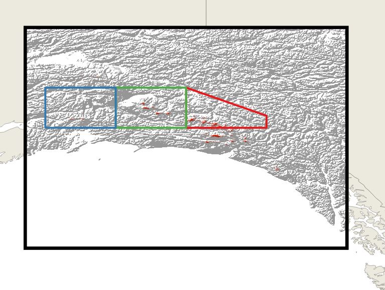
enter image description here

I then tried to find a projection more appropriate for that area and chose NAD83(2011) / Alaska Albers (EPSG:6393).

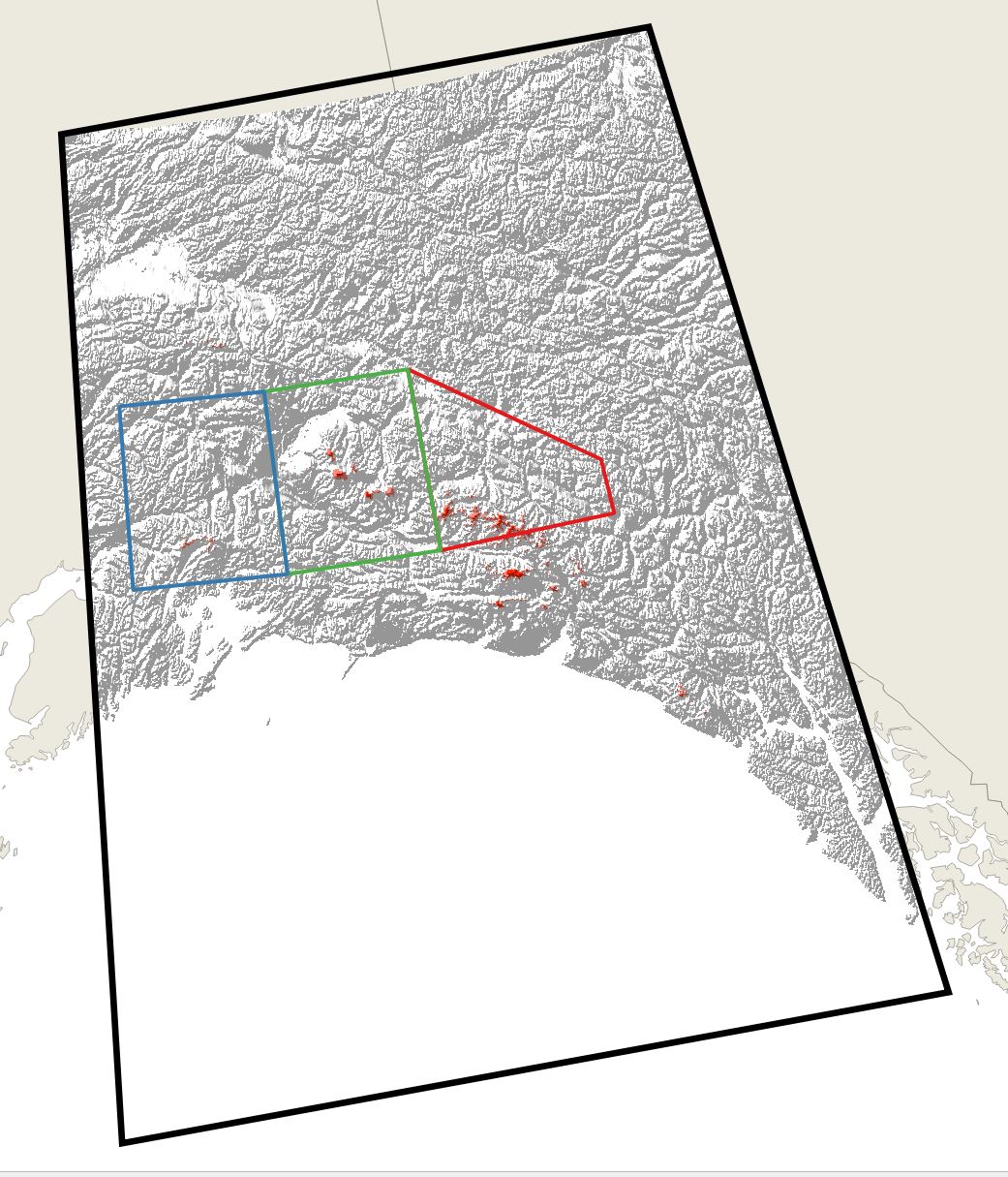
enter image description here

The world basemap and DEM for transformed nicely but I am not sure about the polygon shapefiles. Shouldn't the top and bottom lines be rounded off to follow the longitude? You can notice on the second image that the top of the DEM now curves while the shapefile remained straight.

I have tried exporting the layer as EPSG:6393 and adding it back. But still the same result. Please anyAny pointers would be appreciated.?

Help with projection transformation of a shapefile

I am using QGIS 3.18.1.

I am working on a map around Alaska. I added a world basemap, then added DEM and finally drew a few polygon shapefiles on top.

enter image description here

I then tried to find a projection more appropriate for that area and chose NAD83(2011) / Alaska Albers (EPSG:6393).

enter image description here

The world basemap and DEM for transformed nicely but I am not sure about the polygon shapefiles. Shouldn't the top and bottom lines be rounded off to follow the longitude? You can notice on the second image that the top of the DEM now curves while the shapefile remained straight.

I have tried exporting the layer as EPSG:6393 and adding it back. But still the same result. Please any pointers would be appreciated.

Projection transformation of a shapefile

I am using QGIS 3.18.1.

I am working on a map around Alaska. I added a world basemap, then added DEM and finally drew a few polygon shapefiles on top.

enter image description here

I then tried to find a projection more appropriate for that area and chose NAD83(2011) / Alaska Albers (EPSG:6393).

enter image description here

The world basemap and DEM for transformed nicely but I am not sure about the polygon shapefiles. Shouldn't the top and bottom lines be rounded off to follow the longitude? You can notice on the second image that the top of the DEM now curves while the shapefile remained straight.

I have tried exporting the layer as EPSG:6393 and adding it back. But still the same result. Any pointers?

deleted 18 characters in body
Source Link
Kadir Şahbaz
  • 78k
  • 57
  • 257
  • 404
Loading
Source Link
Loading