I adapted @ThomasG77's 30 day challenge script into something that can be run from the Qgis processing toolbox.
Using Uber's H3 hex grid system in Qgis
https://github.com/maphew/code/tree/master/gis/qgis - h3-grid-from-layer.py
Usage
after Preparation has been completed
From Qgis:
- Select a template layer in table of contents to get extent from
- Optionally select specific features
- Processing tool box >> Open existing script: h3-grid-from-layer.py
- OR: Plugins >> Python console >> Open editor >> load script: h3-grid-from-layer.py
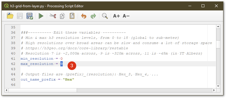
- Edit variables (particularly min/max resolution levels)
- Run
There is an error message of "it seems there is no valid script to run", but it works anyway.


