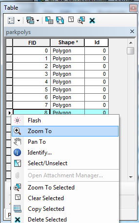
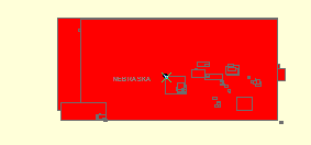
This is an issue related to this question I'd asked a few days ago. I've got that code working, to an extent. Every time, though, that I double click on one of the Polygons in the attribute table that I'd recently populated, ArcMap takes me to a point in the middle of Nebraska.

 That's at 1:2500. If I zoom out, it just appears as an X in the middle of Nebraska. It's nearly the same for any of the Polygons I choose, except there are a different configuration of rectangles within that picture. But it's always in the middle of Nebraska.
I can go into the attribute table using python to pull out the polygon information with the Polygon getPart() method, and it looks like this:
Out[132]: <Array [<Array [<Point (-123.070983887, 43.0001220703, #, #)>, <Point
(-123.070983887, 45.5001220703, #, #)>, <Point (-121.890991211, 45.5001220703, #
, #)>, <Point (-121.890991211, 43.0001220703, #, #)>, <Point (-123.070983887, 43
.0001220703, #, #)>]>]>
...which, based on the points, should be in Oregon. But if I double click on it, it takes me to Nebraska. The other problem is that the polygons should be spread across the country (near national parks) but I think they're all getting bunched into that little square in Nebraska.
Does anyone know why this might be happening? Is the array-within-array throwing it off?


 That's at 1:2500. If I zoom out, it just appears as an X in the middle of Nebraska. It's nearly the same for any of the Polygons I choose, except there are a different configuration of rectangles within that picture. But it's always in the middle of Nebraska.