added 192 characters in body; edited tags
Source Link
Dan_h_b
  • 2.1k
  • 18
  • 31

I have a world map made up of 6 shp files. All the files and the data frame are set to WGS84. The way Arc 10 and 10.1 decides to display the files, it splits Russia into 2. The majority of Russia can be seen to the East, however, one small bit is displayed at the western extent of the map. This is a single polygon.

Is there a way to change the way ArcGIS treats this data so the the whole of Russia is displayed to the east? (I will eventually need to print the data).
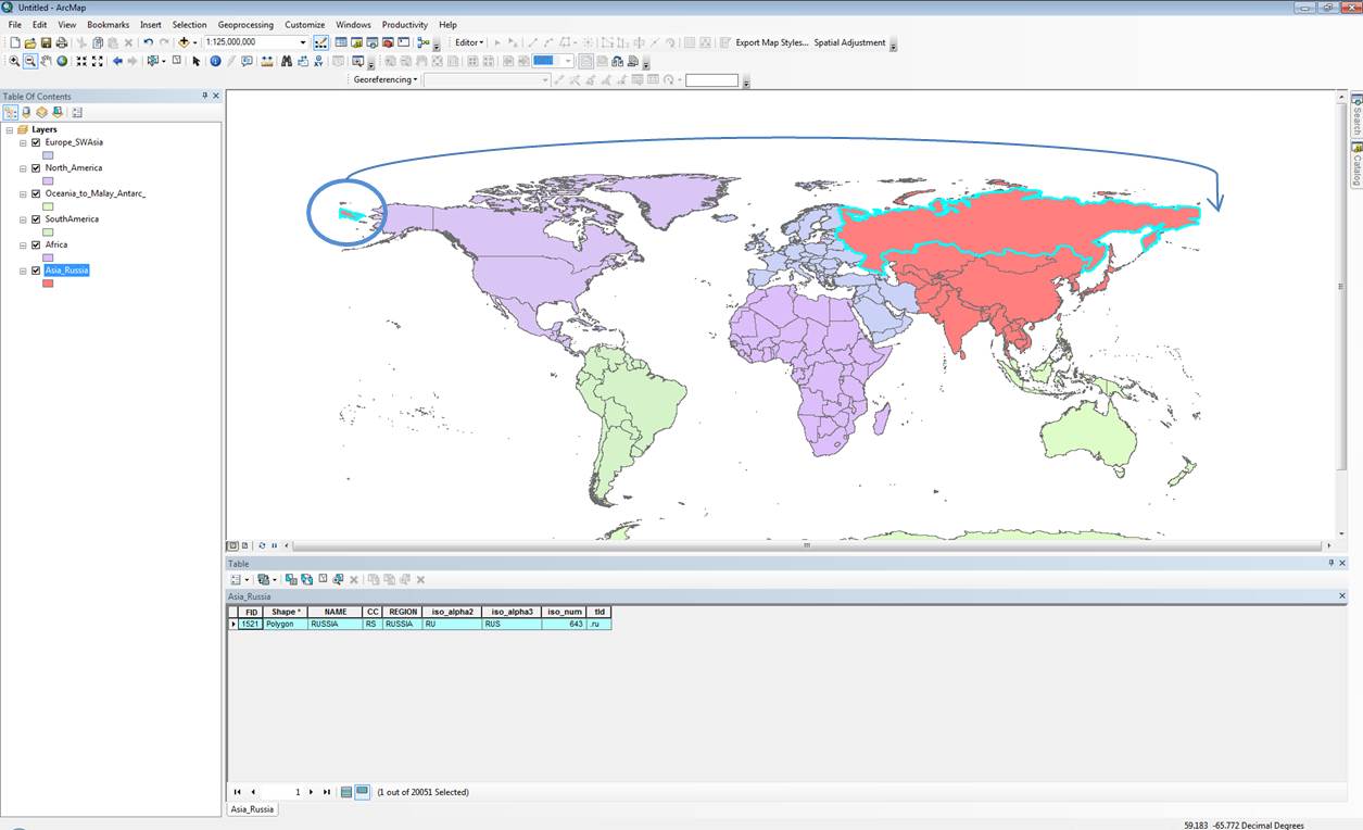
enter image description here

EDIT: I'm starting to think that in order to do this I might need to create a new coordinate system (a copy of wgs84) and offset the centre of it so that it sits to the east. Thoughts?

I have a world map made up of 6 shp files. All the files and the data frame are set to WGS84. The way Arc 10 and 10.1 decides to display the files, it splits Russia into 2. The majority of Russia can be seen to the East, however, one small bit is displayed at the western extent of the map. This is a single polygon.

Is there a way to change the way ArcGIS treats this data so the the whole of Russia is displayed to the east? (I will eventually need to print the data).

enter image description here

EDIT: I'm starting to think that in order to do this I might need to create a new coordinate system (a copy of wgs84) and offset the centre of it so that it sits to the east. Thoughts?

Tweeted twitter.com/#!/StackGIS/status/391178735728467968
Source Link
Dan_h_b
  • 2.1k
  • 18
  • 31

How to change the settings for where ArcGIS splits world data

I have a world map made up of 6 shp files. All the files and the data frame are set to WGS84. The way Arc 10 and 10.1 decides to display the files, it splits Russia into 2. The majority of Russia can be seen to the East, however, one small bit is displayed at the western extent of the map. This is a single polygon.

Is there a way to change the way ArcGIS treats this data so the the whole of Russia is displayed to the east? (I will eventually need to print the data).

enter image description here