added 301 characters in body
Source Link
artwork21
  • 35.2k
  • 8
  • 67
  • 134

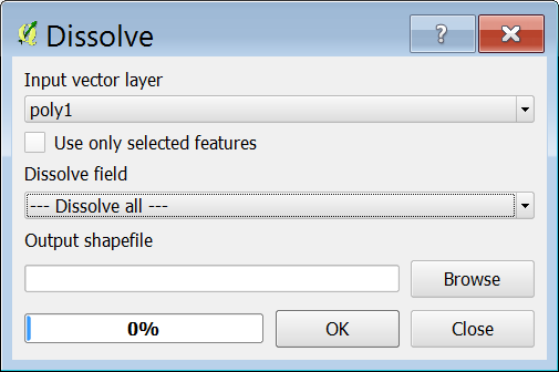
For question 1 use the Dissolve tool. By default it puts in one of your existing field names for Dissolve field. You have to change that to Dissolve all so that all touching features will dissolve, see caption below:
enter image description here

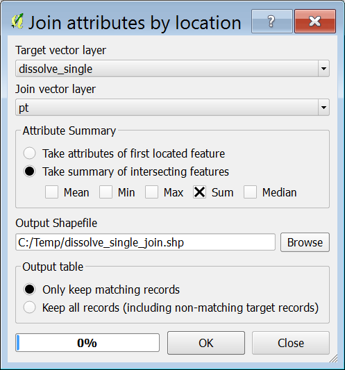
For question 2 you may use Spatial Query as @Gerald has suggestedMultipart to singleparts tool to split the multipart polygons apart, then run the Join attribute by location tool to get a count of how many pond/point feature intersect each buffer polygon, see caption below for Join attribute by location tool.
enter image description here

For question 1 use the Dissolve tool. By default it puts in one of your existing field names for Dissolve field. You have to change that to Dissolve all so that all touching features will dissolve, see caption below:

enter image description here

For question 2 you may use Spatial Query as @Gerald has suggested.

For question 1 use the Dissolve tool. By default it puts in one of your existing field names for Dissolve field. You have to change that to Dissolve all so that all touching features will dissolve, see caption below:

enter image description here

For question 2 you may use Multipart to singleparts tool to split the multipart polygons apart, then run the Join attribute by location tool to get a count of how many pond/point feature intersect each buffer polygon, see caption below for Join attribute by location tool.

enter image description here

Source Link
artwork21
  • 35.2k
  • 8
  • 67
  • 134

For question 1 use the Dissolve tool. By default it puts in one of your existing field names for Dissolve field. You have to change that to Dissolve all so that all touching features will dissolve, see caption below:

enter image description here

For question 2 you may use Spatial Query as @Gerald has suggested.