The white to black color ramp is a little bit better for showing changes.
Source Link
midfield99
  • 679
  • 7
  • 17

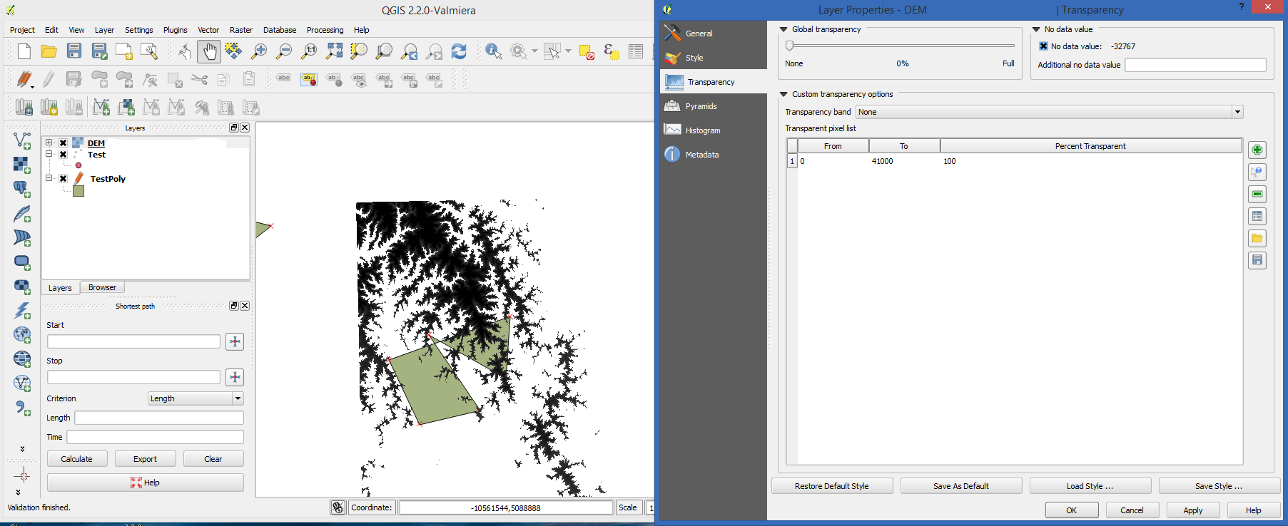
You can control the transparency on raster layers in the Transparency tab in Layer Properties. Just go to the tab, and click the green plus sign to add a new option to the Transparent pixel list. You can set the min and max range values, and then set the transparency percentage for that range.

You could also try setting the "Additional no data value" to zero. I think that would work. I didn't have a geotiff with a range of 0 to 1 to test it though.This image shows a DEM on top of a vector layer with a range of transparent values.This image shows a DEM on top of a vector layer with a range of transparent values.

You can control the transparency on raster layers in the Transparency tab in Layer Properties. Just go to the tab, and click the green plus sign to add a new option to the Transparent pixel list. You can set the min and max range values, and then set the transparency percentage for that range.

You could also try setting the "Additional no data value" to zero. I think that would work. I didn't have a geotiff with a range of 0 to 1 to test it though.This image shows a DEM on top of a vector layer with a range of transparent values.

Source Link
midfield99
  • 679
  • 7
  • 17

You can control the transparency on raster layers in the Transparency tab in Layer Properties. Just go to the tab, and click the green plus sign to add a new option to the Transparent pixel list. You can set the min and max range values, and then set the transparency percentage for that range.

You could also try setting the "Additional no data value" to zero. I think that would work. I didn't have a geotiff with a range of 0 to 1 to test it though.This image shows a DEM on top of a vector layer with a range of transparent values.