I am using a buffer tool to create a buffer on my base map in Openlayers. In addition to creating and visualizing this buffer, I pass the center point and radius to a query. The query collects all features of a certain table which fall into this buffer, and shows them on the map.
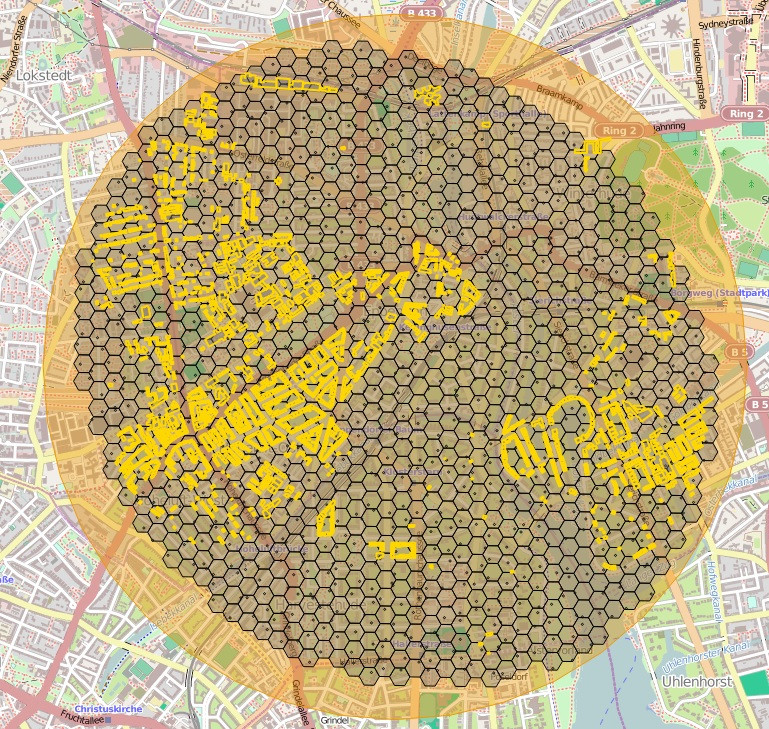
The problem is that in these two cases buffers are generated separately and are not exactly the same. This causes the query to collect less (not all) features inside the buffer. Below is an image to clarify the situation. You can see the buffer created in Openlayers in Orange color, as well as features inside it that are collected from PostGIS in black and gold colors (different features).

Its easy to see how much difference is between these two buffers and the one that is generated by the query is more like an ellipsoid rather than circle. how
How can I solve this?
The code for generating buffer in Openlayers:
var sides = 40;
var new_geom = OpenLayers.Geometry.Polygon.createGeodesicPolygon(centroid, radius, sides, 45, projection);
and I use the following WHERE clause inside my SELECT query:
WHERE ST_DWithin(ST_Transform(h.geom, 26918), (SELECT ST_Transform(ST_GeomFromText($center_buffer, 900913), 26918)), $radius_buffer)
more information: h is the alias of my table where I want to collect features that fall inside the circular buffer. and center_buffer and radius_buffer are the variables pass by OpenLayers (the same used for creating the buffer in OpenLayers).
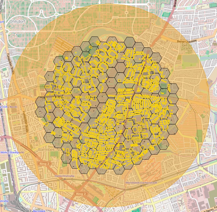
UPDATE: As As mentioned by a forum membersite user below, the city data is around hamburgHamburg and therefore I changed my SRID in my query from 26918 to 26931. With this, the problem of strange ellipsoid shape of my features inside buffer is solved but there is still a big difference between the buffer and the data retrieved from PostGIS. See image below:

Any further help/suggestion would be highly appreciated.
