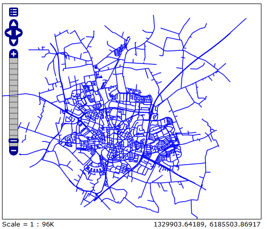
My WMS layer(EPSG:3847) looks fine in GeoServer
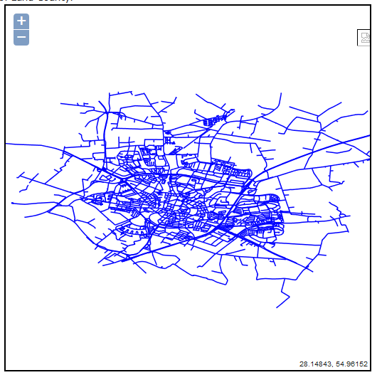
 However, it is distorted in browser:
 I found someone hade the same problem(Openlayers and Geoserver: OSM/Google Maps and WMS Overlay)but I still couldn't solve the problem. I also tried to add code like
var geographic = new OpenLayers.Projection("EPSG:3847");
var mercator = new OpenLayers.Projection("EPSG:4326");
var lund_center = new OpenLayers.LonLat(13.2, 55.7).transform(
                geographic, mercator
and
map.setCente(lund_center, 10);
but the WMS layer is still distorted. I also tried this code but nothing's changed (EPSG3847 is not included in proj4.js, is that why the code didn't work?):
EPSG4326 = new OpenLayers.Projection("EPSG:4326");
EPSG3847  = new OpenLayers.Projection("EPSG:3847 ");

var option = {
            projection: new OpenLayers.Projection("EPSG:3847 "),
            displayProjection: new OpenLayers.Projection("EPSG:4326")
            };
How can I solve this problem? Any help please? *the code I'm trying now are as follows, still,nothing changed:
    var lon = 12.1;
    var lat = 48.4;
    var zoom = 10;
    var map, vectors, controls;
 var options = {
        controls: [],
        projection: new OpenLayers.Projection('EPSG:3857'),
        displayProjection: new OpenLayers.Projection('EPSG:4326'),
        maxExtent: new OpenLayers.Bounds(
        -20037508, -20037508,20037508, 20037508.34),
        //modify parameter
        maxResolution: 5000,
        //modify parameter
        //setting zoom levels
        numZoomLevels:15,
        units: 'm',

    };

 function init(){

    var map = new OpenLayers.Map({
    div: "map",
    allOverlays: true
    });


    var roads_wms = new OpenLayers.Layer.WMS( "Roads",
            "http://localhost:8090/geoserver/wms/wsNYCRoad", {
            projection: map.displayProjection,
            layers: 'vagar_alla',
            styles: '',
            srs:'EPSG:3006',
            transparent:true,
            tiled: 'false',
            tilesOrigin : map.maxExtent.left + ',' + map.maxExtent.bottom
        },
        {
            buffer: 0,
            displayOutsideMaxExtent: true,
            isBaseLayer: false,
            reproject: true
        });
        Proj4js.defs["EPSG:3006"] = "+proj=utm +zone=33 +ellps=GRS80 +towgs84=0,0,0,0,0,0,0 +units=m +no_defs";
        Proj4js.defs["EPSG:4326"] = "+proj=longlat +ellps=WGS84 +datum=WGS84 +no_defs";
        var src = new OpenLayers.Projection('EPSG:3006');
        var dst =  new OpenLayers.Projection('EPSG:4326');
        Proj4js.transform(src, dst, roads_wms);
        roads_wms.projection=dst;
