0

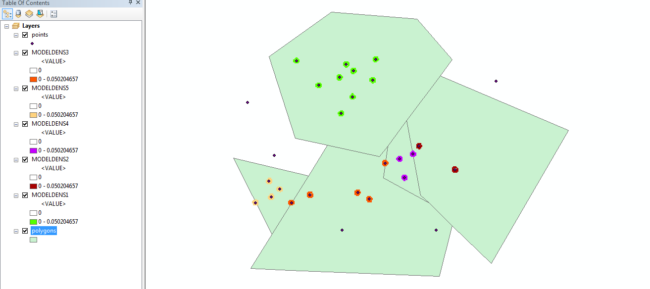
I'm trying to create separate point density layers for each feature within a feature class owning to differing density characteristics within each feature.

enter image description here

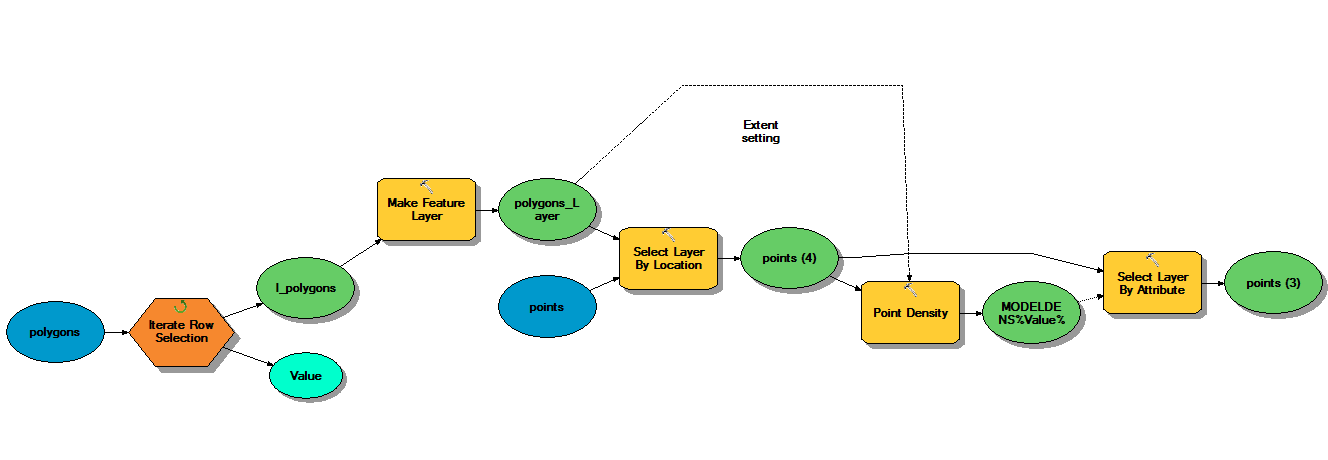
I would like to be able to accomplish this without having to create a new feature class for each feature before computing point density. Here is my current model: enter image description here

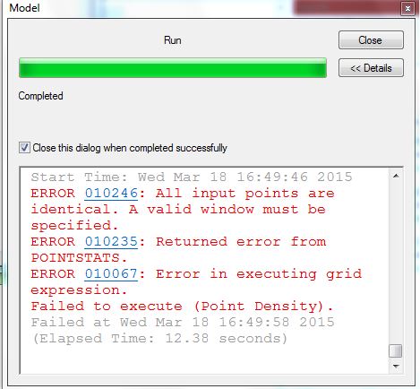
Edit: At the moment my model returns an error enter image description here

How can I create new point density feature classes for each feature independent of each other either in Model Builder or ArcPy?

2
  • It would be beneficial if you would add a report from the model itself, or detail when exactly the error occures, i.e. the first attempt for density, the second, etc.? Take into account that your model missing a select layer by attributes with CLEAR_SELECTION at the end of each iteration. Model builder selection is being saved, thus it is necessary to clear it before making a new one.
    – dof1985
    Commented Mar 18, 2015 at 16:45
  • @dof1985 I added a screenshot of the error. If adding select by attribute, what is the attribute which is being (de)selected? How is that stage added into the model after the new feature class is created and before the iterator runs again?
    – MyFamily
    Commented Mar 18, 2015 at 16:53

1 Answer 1

3

Error 010246 from ESRI support describe either a state that all input points have the same location, or that one or none point were selected. I believe that the second one applies to your model. I suggest you manually check whethear some polygons don't contain points at all, or contain one point - you might use spatial join to get the counts. After that create a valid input layer for your model that contain only polygons with two or more points.

After seing the report I don't believe the problem is the selection, however relating to your comment, here is an image to make things clearer. The input table is your points table with the active selection, and the option is CLEAR_SELECTION as shown. No experession is used. CLEAR SELECTION EDIT: The selectr layer by attributes tool with CLEAR_SELECTION should be placed after (with a precondition) the point density tool create its output.

Note that point density output is a raset, and actually I there is no density feature class. I recommend that you read the tool's help. You will also find arcpy examples there. Here is a link

Another EDIT: I noticed that you used Iterate Features - I think that you should use the iterator Row Selection instead. This iterator would run through each polygon and use it as the selected polygon with which points should be intersected.

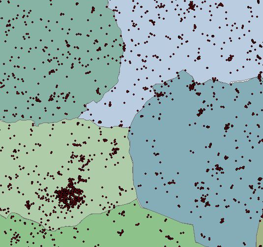
Here is an example of a model as suggested above and its output: model example Model output
EDIT: it worth mentioning that adding extract by mask to the model at the end of each iteration will help extracting the Density raster to the exact extent of each selected (iterated) polygon within the polygons feature
5
  • The problem isn't that there are polygons without points as you can see from my first screenshot. My above comment was how and where this tool feeds into my model and how a new feature class is created before clearing the selection
    – MyFamily
    Commented Mar 18, 2015 at 17:11
  • @MyFamily - Actually the error your model gives point out that this is the problem. Added a link in to the relevant ESRI support page; added also further instructions on how and where to put the select by attributes - CLEAR SELECTION tool in your model. Hope it helps. about your screen shot? is that all the data?
    – dof1985
    Commented Mar 18, 2015 at 17:17
  • Many thanks for that, I'm going to mark this as answer. Following your steps is exactly what I want bar one thing. The Extent setting I have defined doesn't seem to be taking effect, each raster is created by the extent of ALL the points not the SELECTED points, it won't affect my overall output, just data storage and model run time. Did you test your model, any idea why this is so?
    – MyFamily
    Commented Mar 19, 2015 at 15:25
  • @MyFamily. I indeed tested my model, and having the same "problem" as you are. I changes symbology to peresnt 0 values as no colored. However, you can add the extract by mask tool to the model, using the density raster as the input raster and the selected polygon (iterated) as the mask - this way your outputs will have the extent of the polygon only
    – dof1985
    Commented Mar 19, 2015 at 16:06
  • Yeah that's exactly what I ended up doing, no big deal - I just couldn't understand why it wasn't altering the extent for each feature - thanks for your help anyway
    – MyFamily
    Commented Mar 19, 2015 at 17:29

Your Answer

By clicking “Post Your Answer”, you agree to our terms of service and acknowledge you have read our privacy policy.

Not the answer you're looking for? Browse other questions tagged or ask your own question.