1

I had an odd thing happen today, I do almost daily appends to our fiber network (fiber, splices, etc) and usually, it goes smoothly and with no complications. For some reason, I had an Append stall for hours on the cable layer (it usually takes no more than ~20 minutes, and this was no bigger than usual). I had no choice but to cancel it as it was tying up the resources during work hours. Ever since that append has been canceled the database and layers have been so slow that it is almost unusable for people.

I was wondering if this has happened to anyone else, Nothing else has changed in the database and it was loading/selecting/editing with no issues. I had a few people look into it and noticed nothing wrong, and I did multiple "rebuild indexes" and database compressions.

I have an Enterprise ArcSDE Geodatabase on SQL Server 2016 SP2 Enterprise, we are using ArcMap 10.7.1

4
  • Probably more an issue for Tech Support, since there's a whole litany of things to review, and we can't do the interactive round-trip thing in a Q/A model.
    – Vince
    Commented Jan 17, 2020 at 21:58
  • I was on the phone with them for 2.5 hours earlier and nothing helped before I had to leave for a meeting, I figured I'd ask if it happened to anyone in the community before.
    – GravitaZ
    Commented Jan 17, 2020 at 22:04
  • 1
    Can you close all connections and users from the db and restart? Or export the data to see if you can replicate it? Could an .mxd be corrupted? Was there invalid geometries or something else in the data you appended that would affect your db?
    – GISHuman
    Commented Jan 17, 2020 at 23:38
  • It's safe to assume that data table corruption has occurred to others before. Some of the really gnarly failures have occurred days before the data load that exposed the issue happened. Unfortunately, the way to tease apart those tangles is with a database backup and developer diagnostic tools. You should certainly have taken a snapshot backup of the current database state, and sequestered your last two or three incremental backups, all the way back to the full backup on which they rely, in case a rollback is necessary.
    – Vince
    Commented Jan 18, 2020 at 3:01

1 Answer 1

0

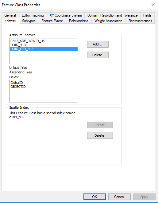
Turns out on one of the layers the Append corrupted the spatial index on the polyline layers, now to the next problem figuring out why the Appends are destroying the spatial index because it happened multiple times after some testing. After we rebuilt the spatial index it was working as normal. Also, using the "Rebuild Indexes" tool didn't work, we had to go to the Feature Class properties in ArcCatalog to rebuild it. I also tested the new data for invalid geometries and it came up clean.

enter image description here

Your Answer

By clicking “Post Your Answer”, you agree to our terms of service and acknowledge you have read our privacy policy.

Not the answer you're looking for? Browse other questions tagged or ask your own question.