1

I'm using the dissolve boundaries tool to merge adjacent polygons. I want to calculate summary statistics on several fields for each of the output polygons. However, when I specify a summary field the output always has the same value for every single polygon (as though the statistics were calculated for a single multi-part feature, even though I have unchecked the 'create multi-part' option).

Using dissolve instead of dissolve boundaries seems to do the same thing. Is there any way to get the tool do what I want without writing some custom script?

EDIT: Updated example screenshots w/ attribute tables as requested

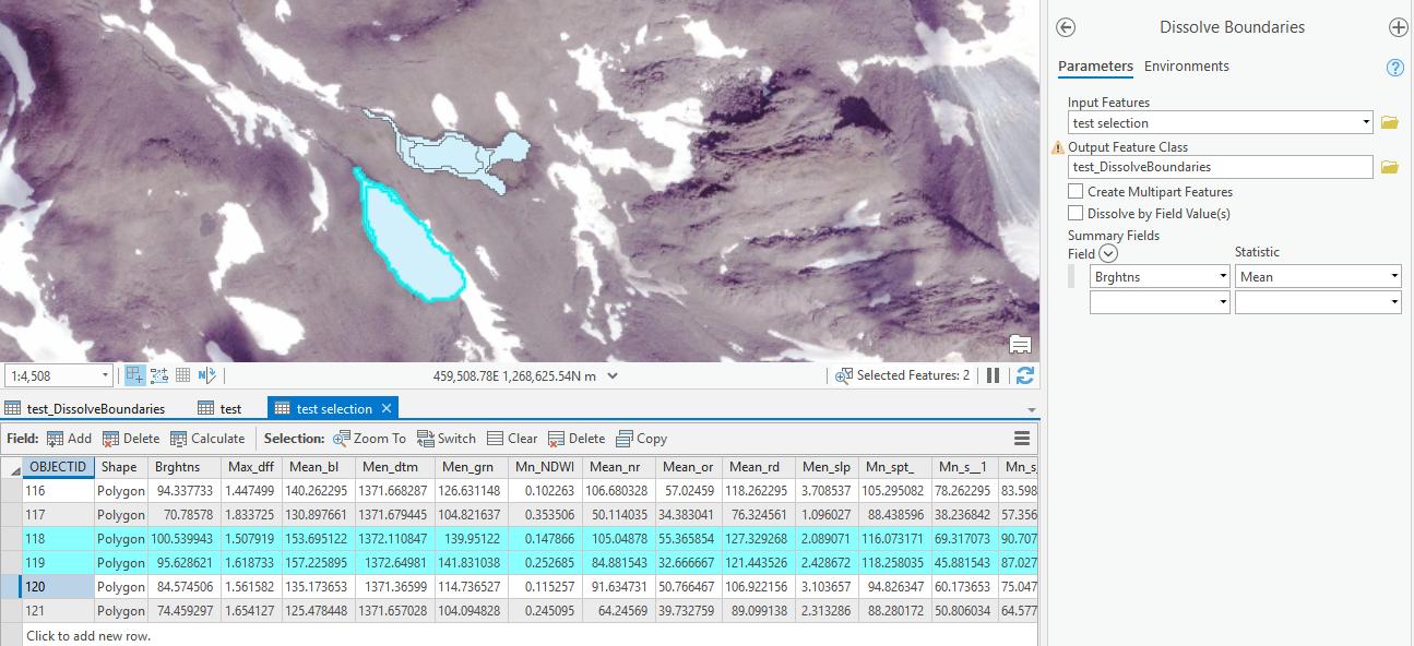
Before dissolve boundaries: Here, my goal is to dissolve these six records into two polygons (NOT a multipart polygon), and calculate the mean value of the "Brghtns" field independently for each. For example, the two records highlighted in blue should be dissolved into a single polygon with a average "Brghtns" value of ~98.05, and the four unhighlighted records should form a second polygon with average "Brghtn" value of ~81. enter image description here
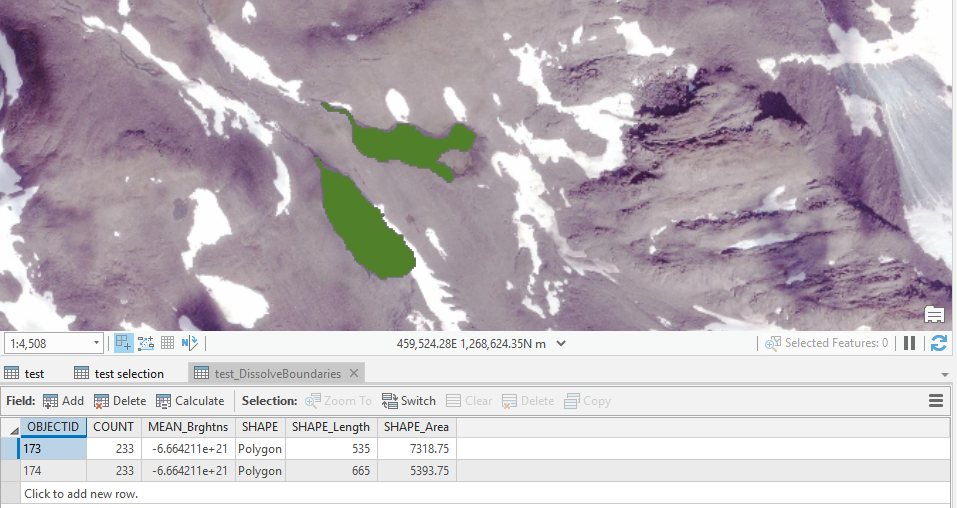
After dissolve boundaries. The geometries have done exactly what I want, but "Mean_Brghtns" value is the same for both, and it has been calculated as the mean value for ALL input polys in the input layer. enter image description here Note: there are many more records in the input FC than the ones being displayed in the attribute table for this example, hence the odd value of -6.66E21
6
  • Verify they are not multi-part by using the select tool and clicking on a polygon, if they all light up then you have a multipart feature. You could try using the multi-to-single part tool to explode them out into separate polygons?
    – Hornbydd
    Commented Feb 24, 2020 at 21:32
  • They are not multi-part, I have verified. However, the values summarized attributes are 1) identical for each feature, and 2) the same as those of the single multi-part feature that results if I do run the tool w/ the 'create multipart' option checked.
    – Nick
    Commented Feb 24, 2020 at 21:53
  • Are the coordinate systems of the datasets the same?
    – Hornbydd
    Commented Feb 25, 2020 at 17:38
  • Only one input dataset
    – Nick
    Commented Feb 25, 2020 at 19:38
  • I think you need to edit your question and show a screen shot of the attribute table and the data it has and how you are running the tool.
    – Hornbydd
    Commented Feb 25, 2020 at 21:48

1 Answer 1

1

I believe the problem is down to you not setting the dissolve field. Currently you set summary field but not the dissolve field. So at the moment everything is included in the dissolve even though you set the output to not be multi-part. Hence the output all having the same mean value.

What you need to do is add a new field lets call it "group" and then select up the polygons that you want to dissolve into a single group and set them as 1, then go to next set of polygons, select them and set them as 2 and so on. Then you can use the group field to be your dissolve by field.

Now you may have zillions of polygons and manually setting a group number is not feasible. I would just use the dissolve tool, to dissolve into single parts, create a numeric field and populate then do a spatial join to pass back the group number to the individual polygons and then you can run the dissolve boundaries tool successfully meaning the values.

1
  • Thank you so much for the response, this sound reasonable and will give it a shot.
    – Nick
    Commented Feb 27, 2020 at 16:10

Your Answer

By clicking “Post Your Answer”, you agree to our terms of service and acknowledge you have read our privacy policy.

Not the answer you're looking for? Browse other questions tagged or ask your own question.