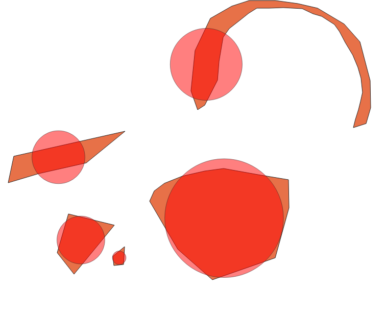
If this is about symbology and you don't need to do any operations on the circles later on, you may use a centroid fill.
You can force this point to be placed inside the polygon by checking the corresponding checkbox.
As to the size of the point, you need to set the units to map units. Then head for the data defined override of the symbol size. Hit edit, then enter the following: sqrt($area/pi())*2
This calculates the radius of a circle which has an area equal to the polygon it belongs to. $area grabs the area of the curent feature, pi() is Pi, and sqrt() returns the square root. We need to multiply this value by 2, since the size of point symbols in QGIS is defined by their diameter, not their radius.
The result looks as follows:

As said, this doesn't allow you to do geometrical operations on the circles, but it preserves you existing polygons (which in my opinion is more important in this business).
A word of advice: Overlaying features with value-indicating symbols is considered bad cartographic practice. Adding the value as a label, or using categories and a matching legend in order to indicate the value leads to better understanding of the map.


minimal_circle($geometry, ...)ormake_circle(centroid($geometry), ...). BTW what are the pre requirements for your radius?