1

I'm using QGIS version 1.8.0-Lisboa and I'm trying to convert a vector line file and it's not working. I right click on the layer>Save as>Autocad file>DXF. After that I try to open the output file in Microstation (Bentley Software) and the file does not open at all. Can you please help me?

EDIT:
I already succeeded in converting to DXF, now I have another problem, I need a 3D file but the one I converted is just 2D, no height info

Can you help me get 3d dxf output?

3 Answers 3

3

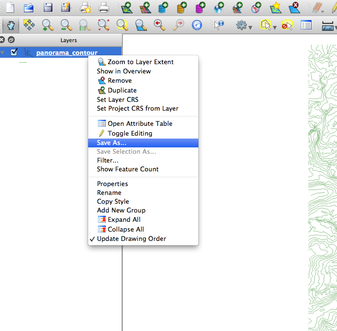
Load your shapefile and right click on the layer in the layers window.

enter image description here

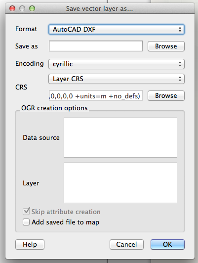
THe resulting dialog lets you select the filename, encoding and crs.

enter image description here

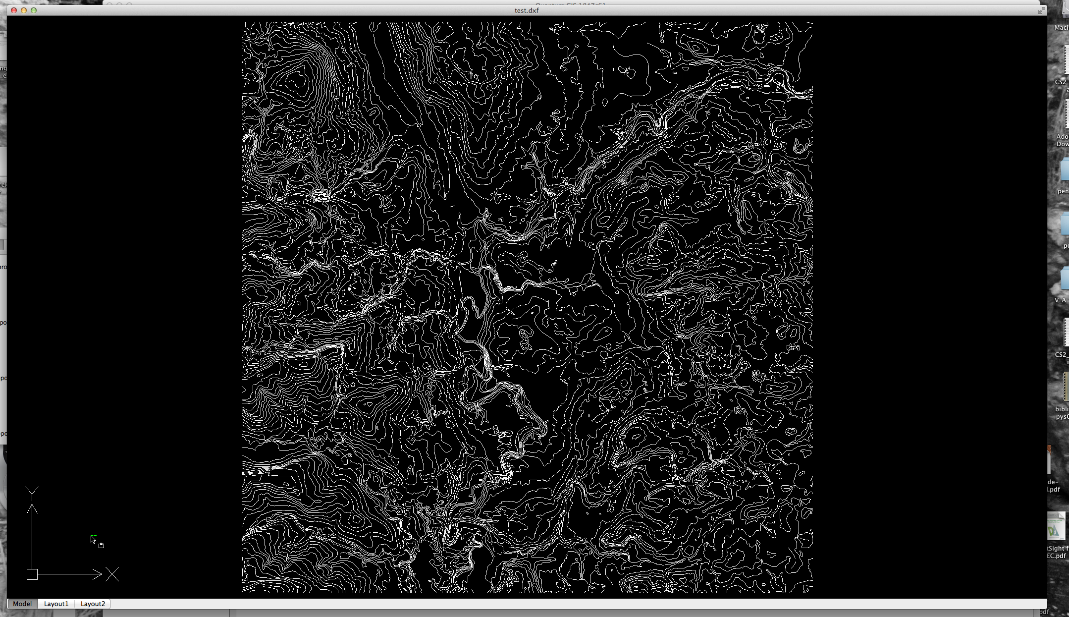
You can then load the file in the cad program of your choice.

enter image description here

You may need to zoom to extents to make the laey visible to you.

According to Bentley you should also be able to import the shp file directly.

http://www.bentley.com/en-US/Products/MicroStation/Whats-New.htm

0

If you have the capability of watching the command line while opening you may see something like "invalid layer name default" as the file is trying to open.
The file is ascii (or should be unless you modified).
Open in a text editor (Not wordprocessor) and search for the error you see. replace with a name of more significance and/or no special chars.
save-as (possibly to not lose the original) and try to re-open.

3
  • Thank you for your prompt response, however, after oening the output file couldn't find the error and it seems almost impossible to run a so extensive file looking for that. Still experiencing the problem Commented Apr 1, 2013 at 16:25
  • are you able to see anything about the reason for it not opening on the microstation command line?
    – Brad Nesom
    Commented Apr 1, 2013 at 16:27
  • Thank you for your help! I already succeeded in converting to DXF, now I have another problem, i need a 3D file but the one i converted is just 2D, no height info, can you help me with this? Commented Apr 1, 2013 at 17:10
0

You can also use ogr2ogr:

ogr2ogr -f DXF contour_zfield.dxf SX99SW_line.shp -zfield PROP_VALUE

With Prop_Value being my z attribute in the shapefile.

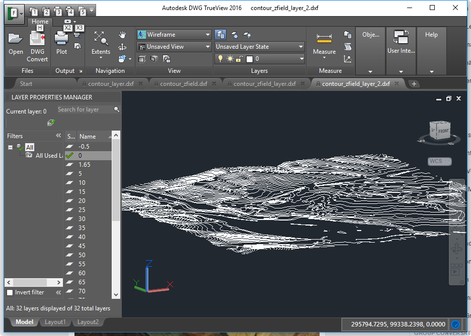
Result:

enter image description here

Full post:

https://gisforthought.com/gis-to-cad-using-ogr2ogr-part-1-shp-to-dxf-with-contour-data/

Your Answer

By clicking “Post Your Answer”, you agree to our terms of service and acknowledge you have read our privacy policy.

Not the answer you're looking for? Browse other questions tagged or ask your own question.