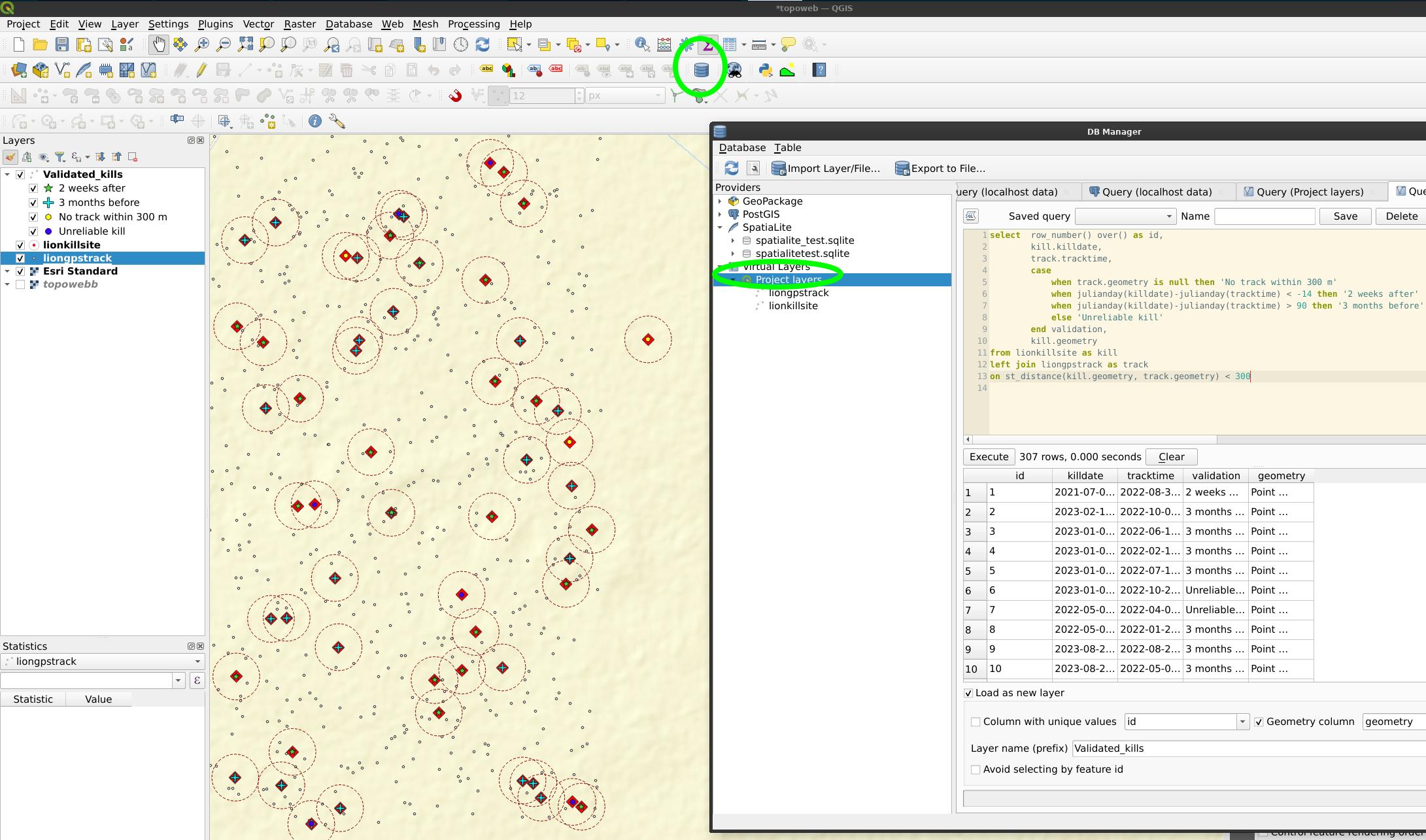
I am studying lions, and their kill sites.
I currently have around 900 historic kill site locations with the record date (with some attribute info). The data is old and I am looking to confirm the reliability of it (looking for additional proof) by looking at the collar (movement) data (multiple GPS locations) of the lions over the time around when the kills were recorded.
So, within a 300m radius of each Kill location I am looking to see what movement happened within the 300m area 3 months before and 2 weeks after the kill (date) was recorded.
I have tried all I know and can - buffer around each kill, have clipped the points that fall within the 300m area easily but cannot separate and sort them to confirm if there was a kill or not.

