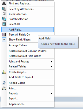
I would do this in two steps. Firstly add a new field to contain the area of your polygons (see below) give it a basic name such as Area and make the type double (see this for more details).

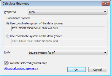
You can then calculate the geometry of your polygons in your new field by right clicking the field heading and selecting Calculate Geometry. Which will bring up the window below:

Once you have done this double click the field heading and that will sort your polygons by size allowing you to identify the largest.
The second step is to run the Feature to Point tool creating your centroid. You can either run this for every polygon in your layer, or if you select the largest (it will be highlighted in bright blue in your attribute table) it will create the point just for this polygon.
Then if you want the co-ordinates for the centroid add two fields to this point layer - an X and Y field, then as before open the calculate geometry window - you will then be able to select to either calculate the X or Y coordinate.
Hope that helps!


