4

I have huge amounts of lidar data stored as tiled datasets per project. The "tiles" are separate LAS files based on our national map sheet setup (800 by 600 meter). To keep an overview of the data I have set up LAS dataset definitions per project in ArcGIS 10.1.

I've been testing out the LASTools for ArcGIS toolbox to see if I could use this for clipping, as that's a function I'm really missing in ArcGIS. What I often want to do is to define a clipping area, and copy data within the area to a new LAS file. This area will normally contain parts of multiple LAS files:
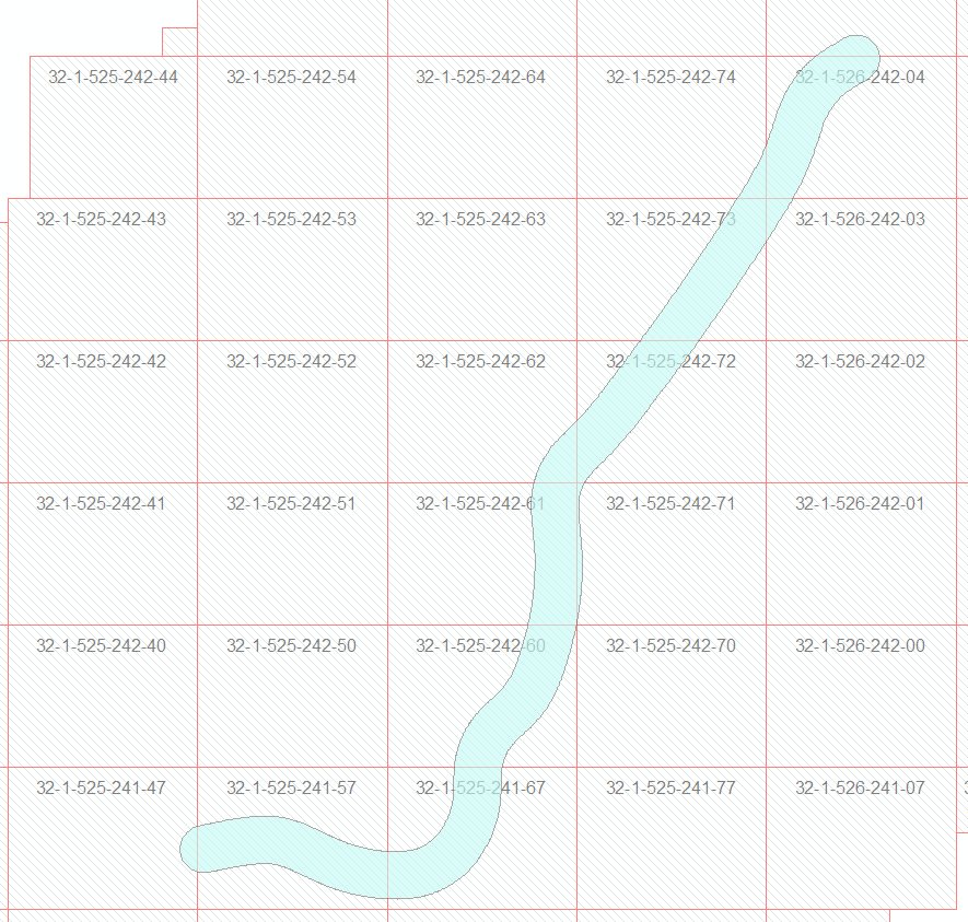
Typical clipping area example

However, it seems the lasclip tool only will clip from one LAS file at a time. What I'm looking for is a way to say - "give me the data from this LAS dataset in this area, and save it to a new LAS file". Am I missing something, or is that not possible here?

Edit: I've also tried posting this to the Lastools GoogleGroups, but without any response.

2
  • 2
    related question: gis.stackexchange.com/questions/86075/… Commented Nov 18, 2014 at 12:32
  • Thanks @AndreSilva. I've played around with Fusion/LTK a little now and managed to clip the test polygons I used into an ok result. Will take a little fiddling to get used to, but I might try to integrate this into an arcgis tool for own use... Question re: any such options in LASTools still remain though...
    – HavardMoe
    Commented Nov 19, 2014 at 9:56

2 Answers 2

4

The "LAStools" toolboxes in ArcGIS, QGIS, and ERDAS IMAGINE all operate on one LAS / LAZ file at a time. The "LAStools Production" toolboxes in ArcGIS and QGIS take folders and wildcards instead of filenames as input and can then be run across hundreds of tiles and on multiple cores.

For faster performance it is instrumental that you first run lasindex to create *.lax files for each tile. Unfortunately the internal structure of ESRI's near-identical *.lasx files is a trade secret so you will have to index twice. Kind of a shame as these proprietary *.lasx files seem to be only a minor variation of the open source *.lax files LASindex produces.

2

Update:

As from ArcGIS Desktop 10.4 (and ArcGIS Pro) one can use the Extract LAS tool (requires 3D Analyst) for clipping a LAS Dataset with vector data.


Original post:

From ArcGIS, it is only possible to clip multiple LiDAR tiles with the LAStools Production toolbox. According to rapidlasso GmbH the new toolbox has the advantage of batch automating LiDAR tasks across folders of las/laz files. A summary of Martin Isenburg's answer in the LAStools GoogleGroups is:

a) Index the las files:

lasindex -i folder/*.las -cores 8

b) Clip an area from a large amount of las files with shapefile:

lasclip -i folder/*.las -poly polygon.shp -o newfile.las

On the other hand, it is possible clipping multiple LiDAR tiles with the LAStools standalone version:

lasclip -i *.las -merged -poly polygon.shp -o newfile.las

It takes all the .las files from the input folder, merge them 'on the fly', clip with shapefile (polygon or polyline) in overlapping areas and output to a new .las file. Use -split, if one wants a new .las file per polygon/polyline from the shapefile. See here for more info about lasclip.

Your Answer

By clicking “Post Your Answer”, you agree to our terms of service and acknowledge you have read our privacy policy.

Not the answer you're looking for? Browse other questions tagged or ask your own question.