I'm having an issue with Multipolygons on CartoDB.
I have a very simple scenario: A multi polygon row on a table that needs to be displayed on the map. Fact is that when more than two polygons somehow colide, the MapView only display the portions that are not common between the polygons. It's very simple to demonstrate:

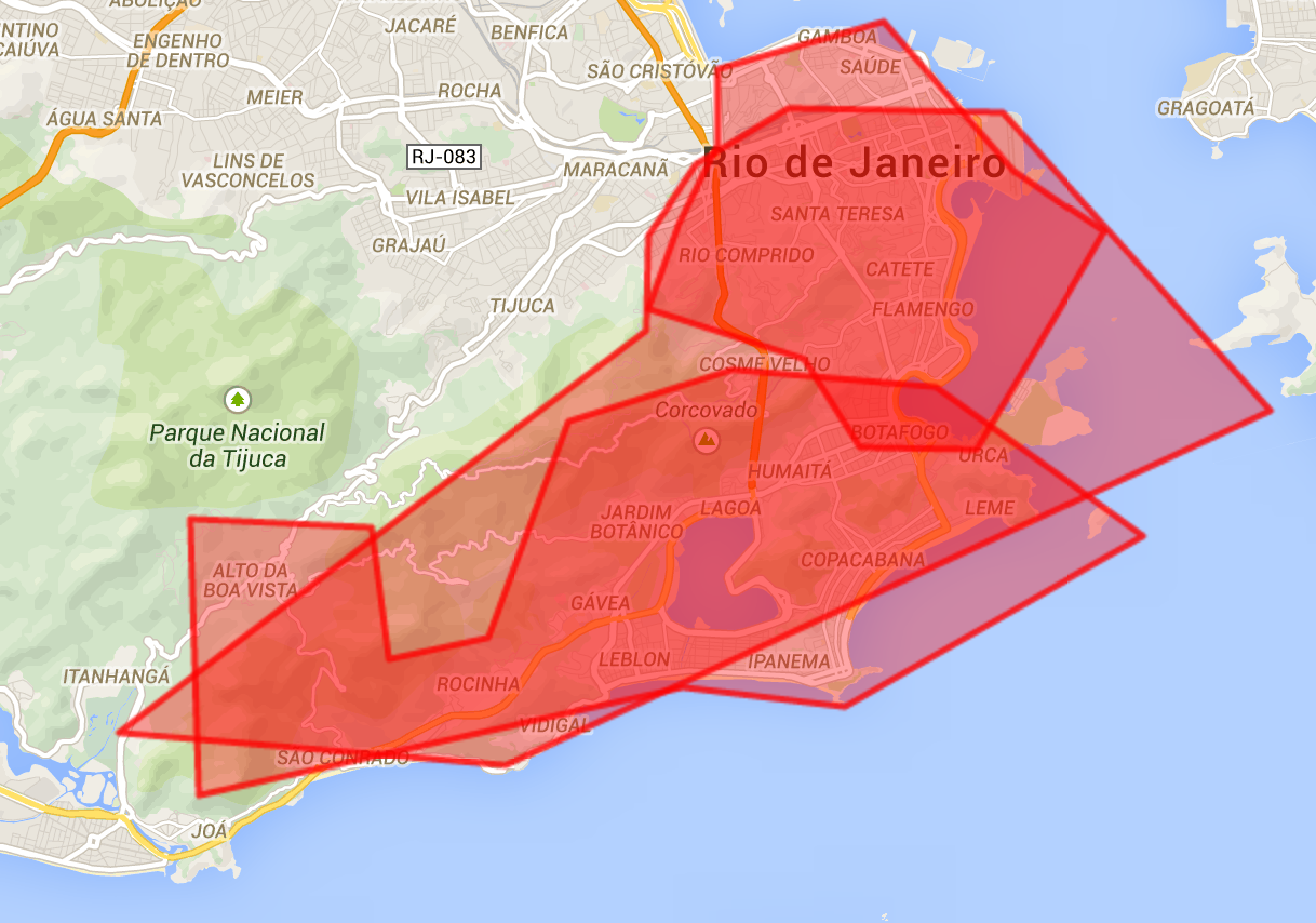
(Those are the original 3 polygons, manually rendered using Google Maps API)

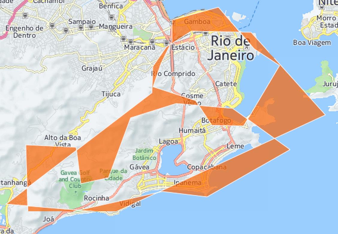
(This is the CartoDB rendering. The overlapping area is missing!)
The craziest thing is that the renderer shows the portion covered by the three polygons. You can see the small area of Botafogo, this area is covered by the three polygons and is correctly shown on the CartoDB rendering.
Any idea why this is happening and how to fix it? I couldn't find anything useful on the documentation. The only workaround I could come up with is by doing some operations using Postgis (ST_Polygonize) but if I do this I'll lose the filtering options, since I'll be using a custom query. Also, to me, it makes no sense why CartoDB is not showing the overlapping area.
