2

Situation:

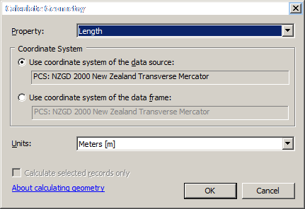
I have feature layer sitting outside processing extent in Environment settings. If I open layer's table and use field calculator - Calculate Geometry on some numeric field:
enter image description here

it works fine.

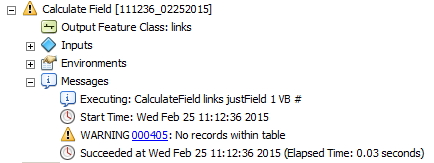
However if I am trying to populate the same or other field with say number of 1, I'll get this error:
enter image description here

Doesn't sound like a big deal, it is enough to fix extent. However a few times when extent was changed long ago I had a hard time to figure out what is wrong with my calculations or maybe layer itself.

Question: What is a rationale behind blocking simple calculations?

6
  • If the data is outside the extent then it reports to the geoprocessor that there's nothing there. The rationale behind this is for very large datasets specifying an extent will speed things up, but only for the AOI. For example if you have national roads but only want to sum the lengths within city limits then specify an extent of the city limits and it will run much faster. Commented Feb 24, 2015 at 22:59
  • I've just did summarise field, got this answer 183032.0739 on total length computed using calculate geometry.
    – FelixIP
    Commented Feb 24, 2015 at 23:13
  • 1
    If you want to access data outside the geoprocessing extent then either change the extent (max of inputs is good) or work without the toolbox (using attribute table) as ArcMap itself isn't bound to the geoprocessing options. Commented Feb 24, 2015 at 23:15
  • I am working on the table itself. No toolbox as such in use
    – FelixIP
    Commented Feb 24, 2015 at 23:17
  • 1
    It would seem that the attribute table 'calculate field' is now a shortcut to CalculateField_management, therefore subject to all the restrictions. You can suppress the extent if you run the CalculateField tool, look for the environments button, and change it there, that way it's changed for that tool and not for everything now on. If you want to change the global setting it's in geoprocessing::options. Commented Feb 25, 2015 at 0:20

1 Answer 1

2

The Field Calculator uses the Calculate Field tool, and like many geoprocessing tools it honors at least some of geoprocessing environments. If the input is spatial (i.e., not a table), and the extent has been set, the calculation will be limited only to those features/records that are within the extent. If the extent doesn't cover any features, no calculations are performed.

Your Answer

By clicking “Post Your Answer”, you agree to our terms of service and acknowledge you have read our privacy policy.

Not the answer you're looking for? Browse other questions tagged or ask your own question.