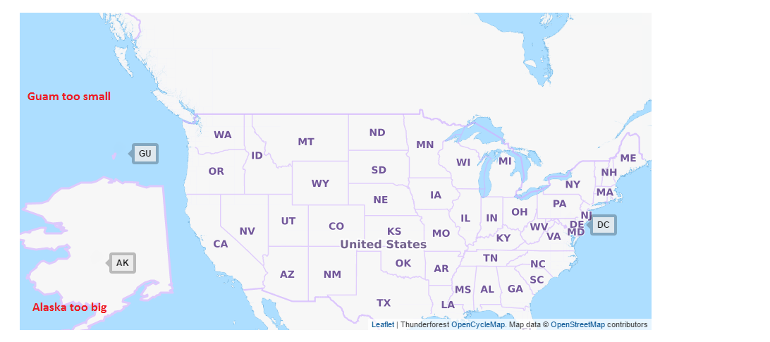
How do I get the geojson format of Alaska, Guam and Puerto Rico in different sizes ? The sizes I have for Alaska is too large and too small for Guam and Puerto Rico. I'm very new to mapping technologies. So I'm not aware of any tools that will allow me to resize these polygons to put it on my map.It would be great if somebody could point me where I could find the rescaled version (in geo Json) of these states. Also it would be awesome if someone could point me to simple tools to that would allow me to resize the co-ordinates(in geojson format)I have for these states.
Update: the sizes of Guam and Puerto Rico in the current zoom level of my map is so tiny, it's virtually impossible to launch a pop up on clicking those states.

